Memmingerberg
| Memmingerberg | ||
|---|---|---|
| ||
 Memmingerberg | ||
Location of Memmingerberg within Unterallgäu district 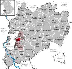 | ||
| Coordinates: 47°59′N 10°13′E / 47.983°N 10.217°ECoordinates: 47°59′N 10°13′E / 47.983°N 10.217°E | ||
| Country | Germany | |
| State | Bavaria | |
| Admin. region | Schwaben | |
| District | Unterallgäu | |
| Municipal assoc. | Memmingerberg | |
| Government | ||
| • Mayor | Alwin Lichtensteiger (CSU) | |
| Area | ||
| • Total | 6.09 km2 (2.35 sq mi) | |
| Population (2015-12-31)[1] | ||
| • Total | 2,825 | |
| • Density | 460/km2 (1,200/sq mi) | |
| Time zone | CET/CEST (UTC+1/+2) | |
| Postal codes | 87766 | |
| Dialling codes | 08331 | |
| Vehicle registration | MN | |
| Website | www.memmingerberg.de | |

Memmingerberg is a municipality in the district of Unterallgäu in Bavaria, Germany. The town is seat of a municipal association with Benningen, Holzgünz, Lachen, Bavaria, Trunkelsberg and Ungerhausen.
References
- ↑ "Fortschreibung des Bevölkerungsstandes". Bayerisches Landesamt für Statistik und Datenverarbeitung (in German). June 2016.
This article is issued from Wikipedia - version of the 8/22/2015. The text is available under the Creative Commons Attribution/Share Alike but additional terms may apply for the media files.