Montclare, Chicago
| Montclare | |
|---|---|
| Community area | |
| Community Area 18 - Montclare | |
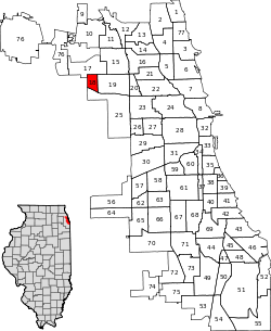 Location within the city of Chicago | |
| Coordinates: 41°55.8′N 87°48′W / 41.9300°N 87.800°WCoordinates: 41°55.8′N 87°48′W / 41.9300°N 87.800°W | |
| Country | United States |
| State | Illinois |
| County | Cook |
| City | Chicago |
| Neighborhoods |
List
|
| Area | |
| • Total | 0.99 sq mi (2.56 km2) |
| Population (2010) | |
| • Total | 13,426 |
| • Density | 14,000/sq mi (5,200/km2) |
| Demographics 2010[1] | |
| • White | 37.55% |
| • Black | 4.45% |
| • Hispanic | 53.98% |
| • Asian | 2.81% |
| • Other | 1.21% |
| Time zone | CST (UTC-6) |
| • Summer (DST) | CDT (UTC-5) |
| ZIP Codes | parts of 60634, 60707 |
| Median household income | $47,460[2] |
| Source: U.S. Census, Record Information Services | |
Montclare is one of 77 officially designated Chicago community areas located on the Northwest Side of the City of Chicago, Illinois. It is served by Metra's Milwaukee District/West Line via Mont Clare station.
References
- ↑ Paral, Rob. "Chicago Demographics Data". Retrieved 6 June 2012.
- ↑ Paral, Rob. "Chicago Census Data". Retrieved 7 October 2012.
External links
 |
Dunning, Chicago | | ||
| Elmwood Park, Illinois | |
Belmont Cragin, Chicago | ||
| ||||
| | ||||
| Austin, Chicago |
This article is issued from Wikipedia - version of the 10/9/2016. The text is available under the Creative Commons Attribution/Share Alike but additional terms may apply for the media files.