Ockley, Indiana
| Ockley | |
|---|---|
| Unincorporated community | |
|
A 360-degree panorama centered on the defunct railroad | |
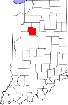 Carroll County's location in Indiana | |
 Ockley Location in Carroll County | |
| Coordinates: 40°29′18″N 86°38′02″W / 40.48833°N 86.63389°WCoordinates: 40°29′18″N 86°38′02″W / 40.48833°N 86.63389°W | |
| Country | United States |
| State | Indiana |
| County | Carroll |
| Township | Madison |
| Elevation[1] | 689 ft (210 m) |
| ZIP code | 46923 |
| FIPS code | 18-56016[2] |
| GNIS feature ID | 440498 |
Ockley is an unincorporated community in Madison Township, Carroll County, Indiana. It is part of the Lafayette, Indiana Metropolitan Statistical Area.
History
A post office was established at Ockley in 1884, and remained in operation until it was discontinued in 1976.[3]
Geography
Ockley is located at 40°29′18″N 86°38′02″W / 40.48833°N 86.63389°W.
References
- ↑ "US Board on Geographic Names". United States Geological Survey. 2007-10-25. Retrieved 2008-01-31.
- ↑ "American FactFinder". United States Census Bureau. Retrieved 2008-01-31.
- ↑ "Carroll County". Jim Forte Postal History. Retrieved 28 August 2014.
Municipalities and communities of Carroll County, Indiana, United States | ||
|---|---|---|
| City | ||
| Towns | ||
| Townships | ||
| Unincorporated communities |
| |
This article is issued from Wikipedia - version of the 9/3/2016. The text is available under the Creative Commons Attribution/Share Alike but additional terms may apply for the media files.