Ossia, West Virginia
| Ossia, West Virginia | |
|---|---|
| Unincorporated community | |
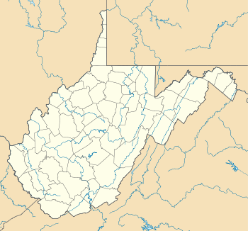 Ossia  Ossia Location within the state of West Virginia | |
| Coordinates: 38°35′20″N 81°1′36″W / 38.58889°N 81.02667°WCoordinates: 38°35′20″N 81°1′36″W / 38.58889°N 81.02667°W | |
| Country | United States |
| State | West Virginia |
| County | Clay |
| Elevation | 846 ft (258 m) |
| Time zone | Eastern (EST) (UTC-5) |
| • Summer (DST) | EDT (UTC-4) |
| GNIS ID | 1549865[1] |
Ossia is an unincorporated community in Clay County, West Virginia, United States.
References
Municipalities and communities of Clay County, West Virginia, United States | ||
|---|---|---|
| Town | 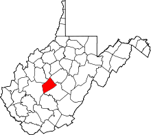 | |
| Unincorporated communities |
| |
| Footnotes | ‡This populated place also has portions in an adjacent county or counties | |
This article is issued from Wikipedia - version of the 7/28/2016. The text is available under the Creative Commons Attribution/Share Alike but additional terms may apply for the media files.