Pacsa
| Pacsa | |
|---|---|
 Pacsa Location of Pacsa | |
| Coordinates: 46°43′14″N 17°00′40″E / 46.72046°N 17.01104°ECoordinates: 46°43′14″N 17°00′40″E / 46.72046°N 17.01104°E | |
| Country |
|
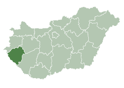
| County | Zala |
| Area | |
| • Total | 22.71 km2 (8.77 sq mi) |
| Population (2004) | |
| • Total | 1,904 |
| • Density | 83.83/km2 (217.1/sq mi) |
| Time zone | CET (UTC+1) |
| • Summer (DST) | CEST (UTC+2) |
| Postal code | 8761 |
| Area code(s) | 92 |
Pacsa is a town in Zala County, Hungary.
External links
- Street map (Hungarian)
This article is issued from Wikipedia - version of the 10/8/2015. The text is available under the Creative Commons Attribution/Share Alike but additional terms may apply for the media files.