Paraloma, Arkansas
| Paraloma, Arkansas | |
|---|---|
| Unincorporated community | |
 Paraloma, Arkansas Paraloma's position in Arkansas | |
| Coordinates: 33°47′52″N 94°01′09″W / 33.79778°N 94.01917°WCoordinates: 33°47′52″N 94°01′09″W / 33.79778°N 94.01917°W | |
| Country |
|
| State |
|
| County | Sevier |
| Township | Washington |
| Elevation[1] | 344 m (1,129 ft) |
| Time zone | Central (CST) (UTC-6) |
| • Summer (DST) | CDT (UTC-5) |
| ZIP code | 71846 |
| Area code(s) | 870 |
| GNIS feature ID | 58324 |
| U.S. Geological Survey Geographic Names Information System: Paraloma, Arkansas | |
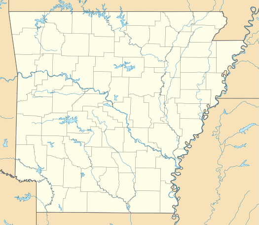
Paraloma is an unincorporated community in Washington Township, Sevier County, Arkansas, United States.[1] It is located on Highway 234 north of Millwood Lake.[2]
References
- 1 2 "Paraloma, Arkansas". Geographic Names Information System. United States Geological Survey. Retrieved August 20, 2012.
- ↑ Arkansas Atlas and Gazetteer (Map) (Second ed.). DeLorme. § 55.
Municipalities and communities of Sevier County, Arkansas, United States | ||
|---|---|---|
| Cities | 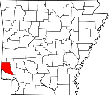 | |
| Towns | ||
| Unincorporated community | ||
This article is issued from Wikipedia - version of the 2/11/2014. The text is available under the Creative Commons Attribution/Share Alike but additional terms may apply for the media files.