Paričjak
| Paričjak | |
|---|---|
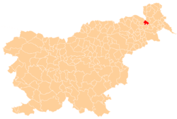
 Paričjak Location in Slovenia | |
| Coordinates: 46°37′31.15″N 16°2′27.33″E / 46.6253194°N 16.0409250°ECoordinates: 46°37′31.15″N 16°2′27.33″E / 46.6253194°N 16.0409250°E | |
| Country |
|
| Traditional region | Styria |
| Statistical region | Mura |
| Municipality | Radenci |
| Area | |
| • Total | 0.77 km2 (0.30 sq mi) |
| Elevation | 249.9 m (819.9 ft) |
| Population (2002) | |
| • Total | 251 |
| [1] | |
Paričjak (pronounced [paˈɾiːtʃjak]) is a settlement in the Municipality of Radenci in northeastern Slovenia. It lies along the road from Radenci to Kapelski Vrh.[2]
There is a chapel-shrine with a belfry in the settlement. It was built in the early 20th century.[3]
References
- ↑ Statistical Office of the Republic of Slovenia Archived November 18, 2008, at the Wayback Machine.
- ↑ Radenci municipal site
- ↑ Slovenian Ministry of Culture register of national heritage Archived July 12, 2010, at the Wayback Machine. reference number 14058
External links
| Settlements | Administrative centre: Radenci
|  | ||||||
|---|---|---|---|---|---|---|---|---|
| Landmarks |
| |||||||
| Notable people |
| |||||||
This article is issued from Wikipedia - version of the 11/17/2016. The text is available under the Creative Commons Attribution/Share Alike but additional terms may apply for the media files.