Paya, Boyacá
| Paya | ||
|---|---|---|
| Municipality and town | ||
| ||
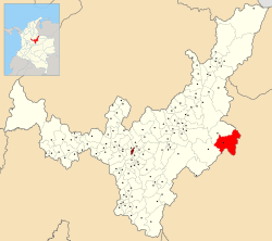 Location of the municipality and town of Paya in the Boyacá department of Colombia | ||
| Country |
| |
| Department | Boyacá Department | |
| Province | La Libertad Province | |
| Founded | 14 September 1600 | |
| Government | ||
| • Mayor |
José Roldán Maldonado Pérez (2016-2019) | |
| Area | ||
| • Municipality and town | 435.503 km2 (168.149 sq mi) | |
| • Urban | 225.503 km2 (87.067 sq mi) | |
| Elevation | 950 m (3,120 ft) | |
| Population (2015) | ||
| • Municipality and town | 2,550 | |
| • Density | 5.9/km2 (15/sq mi) | |
| • Urban | 580 | |
| Time zone | Colombia Standard Time (UTC-5) | |
| Website | Official website | |
.svg.png)
Paya is a town and municipality in the La Libertad Province, part of the Colombian department of Boyacá. Paya limits Pisba, Labranzagrande of Boyacá and Támara, Nunchía and Yopal (Casanare).[1]
Etymology
Paya in Chibcha means "People of hope".[2]
History
Before the Spanish conquest in the 1530s, Paya was inhabited by the Muisca, organized in their loose Muisca Confederation.
Modern Paya was founded on September 14, 1600.[1]
Economy
The majority of the economy of Paya comes from horticulture (47%). Other areas of income are livestock farming (37%) and agriculture (16%).[1]
References
- 1 2 3 (Spanish) Official website Paya
- ↑ (Spanish) Etymology Paya - Excelsio.net
Coordinates: 5°38′N 72°26′W / 5.633°N 72.433°W
This article is issued from Wikipedia - version of the 9/29/2016. The text is available under the Creative Commons Attribution/Share Alike but additional terms may apply for the media files.