Peñablanca, Cagayan
| Peñablanca | |
|---|---|
| Municipality | |
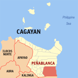 Map of Cagayan showing the location of Peñablanca | |
.svg.png) Peñablanca Location within the Philippines | |
| Coordinates: 17°38′N 121°47′E / 17.63°N 121.78°ECoordinates: 17°38′N 121°47′E / 17.63°N 121.78°E | |
| Country | Philippines |
| Region | Cagayan Valley (Region II) |
| Province | Cagayan |
| District | 3rd District |
| Barangays | 24 |
| Government[1] | |
| • Mayor | Marilyn Julia Taguinod |
| Area[2] | |
| • Total | 1,193.2 km2 (460.7 sq mi) |
| Population (2015 census)[3] | |
| • Total | 48,584 |
| • Density | 41/km2 (110/sq mi) |
| Time zone | PST (UTC+8) |
| ZIP code | 3502 |
| IDD : area code | +63 (0)78 |
| Income class | 1st class |
| Website |
www |
Peñablanca is a first class municipality in the province of Cagayan, Philippines. According to the 2015 census, it has a population of 48,584 people.[3]
Situated east of the provincial capital Tuguegarao, the municipality is home to the Peñablanca Protected Landscape and Seascape which contains the Callao Cave, one of the province's well-known landmarks and tourist spots.
Barangays
Peñablanca is divided into 24 barangays.[2]
- Aggugaddan
- Alimanao
- Baliuag
- Bical
- Bugatay
- Buyun
- Cabasan
- Cabbo
- Callao
- Camasi
- Centro (Pob.)
- Dodan
- Lapi
- Malibabag
- Mangga
- Minanga
- Nabbabalayan
- Nanguilattan
- Nannarian
- Parabba
- Patagueleg
- Quibal
- San Roque (Litto)
- Sisim
Demographics
| Population census of Peñablanca | ||
|---|---|---|
| Year | Pop. | ±% p.a. |
| 1990 | 30,527 | — |
| 1995 | 33,190 | +1.58% |
| 2000 | 37,872 | +2.87% |
| 2007 | 40,336 | +0.87% |
| 2010 | 42,736 | +2.13% |
| 2015 | 48,584 | +2.47% |
| Source: Philippine Statistics Authority[3][4] | ||
In the 2015 census, the population of Peñablanca, Cagayan, was 48,584 people,[3] with a density of 41 inhabitants per square kilometre or 110 inhabitants per square mile.
See also
References
- ↑ "Official City/Municipal 2013 Election Results". Intramuros, Manila, Philippines: Commission on Elections (COMELEC). 11 September 2013. Retrieved 24 January 2014.
- 1 2 "Province: CAGAYAN". PSGC Interactive. Makati City, Philippines: National Statistical Coordination Board. Retrieved 24 January 2014.
- 1 2 3 4 "Region II (CAGAYAN VALLEY)". Census of Population (2015): Total Population by Province, City, Municipality and Barangay (Report). PSA. Retrieved 20 June 2016.
- ↑ "Region II (CAGAYAN VALLEY)". Census of Population and Housing (2010): Total Population by Province, City, Municipality and Barangay (Report). NSO. Retrieved 29 June 2016.
External links
 |
Amulung | Baggao | | |
| Iguig Tuguegarao |
|
Philippine Sea | ||
| ||||
| | ||||
| San Pablo, Isabela / Maconacon, Isabela |
Tuguegarao (capital) | |
| Municipalities | |
| Component city | |
| Barangays | |
This article is issued from Wikipedia - version of the 11/15/2016. The text is available under the Creative Commons Attribution/Share Alike but additional terms may apply for the media files.