Pierrelaye
| Pierrelaye | |
|---|---|
|
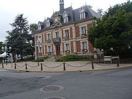
The town hall of Pierrelaye | |
 Pierrelaye | |
|
Location within Île-de-France region  Pierrelaye | |
| Coordinates: 49°01′24″N 2°09′03″E / 49.0233°N 2.1508°ECoordinates: 49°01′24″N 2°09′03″E / 49.0233°N 2.1508°E | |
| Country | France |
| Region | Île-de-France |
| Department | Val-d'Oise |
| Arrondissement | Pontoise |
| Canton | Taverny |
| Intercommunality | Val Parisis |
| Government | |
| • Mayor (1977–2020) | Michel Vallade |
| Area1 | 9.21 km2 (3.56 sq mi) |
| Population (2013)2 | 8,186 |
| • Density | 890/km2 (2,300/sq mi) |
| Time zone | CET (UTC+1) |
| • Summer (DST) | CEST (UTC+2) |
| INSEE/Postal code | 95488 / 95480 |
| Elevation | 35–78 m (115–256 ft) |
|
1 French Land Register data, which excludes lakes, ponds, glaciers > 1 km² (0.386 sq mi or 247 acres) and river estuaries. 2 Population without double counting: residents of multiple communes (e.g., students and military personnel) only counted once. | |
Pierrelaye is a commune in the Val-d'Oise department in Île-de-France in northern France.
See also
References
External links
- Land use (IAURIF) (English)
| Wikimedia Commons has media related to Pierrelaye. |
This article is issued from Wikipedia - version of the 4/8/2016. The text is available under the Creative Commons Attribution/Share Alike but additional terms may apply for the media files.