Podvin, Žalec
| Podvin | |
|---|---|
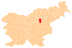
 Podvin Location in Slovenia | |
| Coordinates: 46°15′26.58″N 15°9′52.58″E / 46.2573833°N 15.1646056°ECoordinates: 46°15′26.58″N 15°9′52.58″E / 46.2573833°N 15.1646056°E | |
| Country |
|
| Traditional region | Styria |
| Statistical region | Savinja |
| Municipality | Žalec |
| Area | |
| • Total | 0.39 km2 (0.15 sq mi) |
| Elevation | 258.1 m (846.8 ft) |
| Population (2002) | |
| • Total | 345 |
| [1] | |
Podvin (pronounced [pɔˈdʋiːn]) is a small settlement in the Municipality of Žalec in east-central Slovenia. It lies on Ložnica Creek north of Žalec. The area is part of the traditional region of Styria. The municipality is now included in the Savinja Statistical Region.[2]
History
Podvin became a separate settlement in 1991, when its territory was administratively separated from that of Gotovlje and Ložnica pri Žalcu.[3]
References
External links
| Settlements | Administrative centre: Žalec
|  | ||||||
|---|---|---|---|---|---|---|---|---|
| Landmarks | ||||||||
This article is issued from Wikipedia - version of the 11/12/2016. The text is available under the Creative Commons Attribution/Share Alike but additional terms may apply for the media files.