Quebec Route 333
| ||||
|---|---|---|---|---|
 | ||||
| Route information | ||||
| Maintained by Transports Québec | ||||
| Length: | 15.8 km[1] (9.8 mi) | |||
| Major junctions | ||||
| South end: |
| |||
| North end: | Chemin du Lac-de-l'Achigan in Saint-Hippolyte | |||
| Location | ||||
| Counties: | La Rivière-du-Nord | |||
| Major cities: | Saint-Jérôme | |||
| Highway system | ||||
| ||||

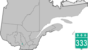
Route 333 is a short provincial highway located in the Laurentides region of Quebec. It runs for 16 kilometers from Saint-Jérôme at the junction of Route 117 to Saint-Hippolyte and serves mainly several large lakes located between Sainte-Adèle and Saint-Jérôme.
Municipalities along Route 333
Major intersections
| RCM or ET | Municipality | Km | Junction | Notes |
|---|---|---|---|---|
Southern terminus of Route 333 | ||||
| La Rivière-du-Nord | Saint-Jérôme | 0.0 | 117 SOUTH: to Mirabel 117 NORTH: to Prévost | |
| Saint-Hippolyte | 9.2 | Chemin des Hauteurs | WEST: to Lac Echo | |
| 15.8 | Chemin du Lac-de-l'Achigan | WEST: to Lac-de-l'Achigan | ||
Northern terminus of Route 333 | ||||
See also
References
- ↑ Ministère des transports, "Distances routières", page 97, Les Publications du Québec, 2005
External links
- Official Transports Quebec Road Map Network (French)
- Route 333 on Google Maps
This article is issued from Wikipedia - version of the 11/9/2016. The text is available under the Creative Commons Attribution/Share Alike but additional terms may apply for the media files.