Radnor, Ohio
| Radnor, Ohio | |
|---|---|
| Census-designated place | |
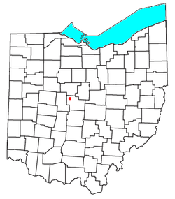 Location of Radnor in Ohio | |
| Coordinates: 40°23′03″N 83°09′03″W / 40.38417°N 83.15083°WCoordinates: 40°23′03″N 83°09′03″W / 40.38417°N 83.15083°W | |
| Country | United States |
| State | Ohio |
| County | Delaware |
| Township | Radnor |
| Area[1] | |
| • Total | 0.72 sq mi (1.87 km2) |
| • Land | 0.72 sq mi (1.87 km2) |
| • Water | 0.0 sq mi (0.0 km2) |
| Elevation[2] | 935 ft (285 m) |
| Population (2010)[1] | |
| • Total | 201 |
| • Density | 279/sq mi (107.7/km2) |
| Time zone | Eastern (EST) (UTC-5) |
| • Summer (DST) | EDT (UTC-4) |
| ZIP code | 43066 |
| Area code(s) | 740 |
| FIPS code | 39-65298[1] |
| GNIS feature ID | 1061581[2] |
Radnor is an unincorporated community and census-designated place (CDP) in central Radnor Township, Delaware County, Ohio, United States. As of the 2010 census it had a population of 201.[1] Radnor has a post office with the ZIP code of 43066.[3] It lies along State Route 203 at its intersection with Radnor Road.[4]
History
Radnor was originally known as "Delhi", and under the latter name was laid out in 1833.[5] The present name was taken from Radnor Township.[5]
References
- 1 2 3 4 "Geographic Identifiers: 2010 Demographic Profile Data (G001): Radnor CDP, Ohio". U.S. Census Bureau, American Factfinder. Retrieved December 7, 2015.
- 1 2 U.S. Geological Survey Geographic Names Information System: Radnor, Ohio
- ↑ Zip Code Lookup
- ↑ DeLorme. (2004). Ohio Atlas & Gazetteer, p.57. Yarmouth, Maine: DeLorme. ISBN 0-89933-281-1.
- 1 2 History of Delaware County and Ohio. O. L. Baskin & Company. 1880. pp. 510–511.
Municipalities and communities of Delaware County, Ohio, United States | ||
|---|---|---|
| Cities | 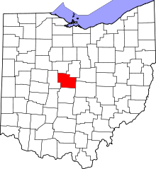 | |
| Villages | ||
| Townships | ||
| CDPs | ||
| Unincorporated communities | ||
| Ghost towns | ||
| Footnotes | ‡This populated place also has portions in an adjacent county or counties | |
This article is issued from Wikipedia - version of the 11/3/2016. The text is available under the Creative Commons Attribution/Share Alike but additional terms may apply for the media files.