Rattelsdorf, Thuringia
| Rattelsdorf | |
|---|---|
 Rattelsdorf | |
Location of Rattelsdorf within Saale-Holzland-Kreis district 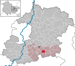 | |
| Coordinates: 50°48′49″N 11°46′23″E / 50.81361°N 11.77306°ECoordinates: 50°48′49″N 11°46′23″E / 50.81361°N 11.77306°E | |
| Country | Germany |
| State | Thuringia |
| District | Saale-Holzland-Kreis |
| Municipal assoc. | Hügelland/Täler |
| Government | |
| • Mayor | Jürgen Meinhardt |
| Area | |
| • Total | 3.65 km2 (1.41 sq mi) |
| Population (2015-12-31)[1] | |
| • Total | 76 |
| • Density | 21/km2 (54/sq mi) |
| Time zone | CET/CEST (UTC+1/+2) |
| Postal codes | 07646 |
| Dialling codes | 036426 |
| Vehicle registration | SHK, EIS, SRO |
| Website | www.huegelland-taeler.de |
Rattelsdorf is a municipality in the district Saale-Holzland, in Thuringia, Germany.
References
This article is issued from Wikipedia - version of the 7/18/2015. The text is available under the Creative Commons Attribution/Share Alike but additional terms may apply for the media files.