Restauración
For the Spanish historic period, see Spain under the Restoration.
| Restauración | |
|---|---|
 Restauración | |
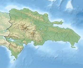
| Coordinates: 19°18′N 71°41′W / 19.300°N 71.683°WCoordinates: 19°18′N 71°41′W / 19.300°N 71.683°W | |
| Country | Dominican Republic |
| Province | Dajabón |
| Municipality since | 1907 |
| Area[1] | |
| • Total | 283.58 km2 (109.49 sq mi) |
| Elevation[2] | 594 m (1,949 ft) |
| Population (2012)[3] | |
| • Total | 6,948 |
| • Density | 25/km2 (63/sq mi) |
| Municipalities | 0 |
| Climate | Am |
Restauración is the third largest city in the province of Dajabon, Dominican Republic. It is located in the northwest portion of the island, in the Cibao region.
Climate
| Climate data for Restauración (1961–1990) | |||||||||||||
|---|---|---|---|---|---|---|---|---|---|---|---|---|---|
| Month | Jan | Feb | Mar | Apr | May | Jun | Jul | Aug | Sep | Oct | Nov | Dec | Year |
| Record high °C (°F) | 36.5 (97.7) |
37.5 (99.5) |
39.9 (103.8) |
37.0 (98.6) |
38.8 (101.8) |
38.8 (101.8) |
38.8 (101.8) |
39.5 (103.1) |
38.8 (101.8) |
38.5 (101.3) |
37.5 (99.5) |
36.8 (98.2) |
39.9 (103.8) |
| Average high °C (°F) | 29.6 (85.3) |
30.0 (86) |
31.2 (88.2) |
31.4 (88.5) |
31.7 (89.1) |
31.8 (89.2) |
32.4 (90.3) |
32.3 (90.1) |
31.9 (89.4) |
31.7 (89.1) |
30.4 (86.7) |
29.1 (84.4) |
31.1 (88) |
| Average low °C (°F) | 16.0 (60.8) |
16.0 (60.8) |
16.5 (61.7) |
17.4 (63.3) |
18.3 (64.9) |
18.9 (66) |
18.7 (65.7) |
18.8 (65.8) |
18.8 (65.8) |
18.8 (65.8) |
18.2 (64.8) |
16.8 (62.2) |
17.8 (64) |
| Record low °C (°F) | 7.2 (45) |
8.8 (47.8) |
9.0 (48.2) |
8.0 (46.4) |
11.0 (51.8) |
13.0 (55.4) |
11.0 (51.8) |
14.9 (58.8) |
12.3 (54.1) |
15.0 (59) |
11.9 (53.4) |
9.0 (48.2) |
7.2 (45) |
| Average rainfall mm (inches) | 45.8 (1.803) |
45.3 (1.783) |
64.5 (2.539) |
102.6 (4.039) |
177.3 (6.98) |
179.9 (7.083) |
129.3 (5.091) |
160.3 (6.311) |
220.2 (8.669) |
213.6 (8.409) |
94.9 (3.736) |
56.1 (2.209) |
1,489.8 (58.654) |
| Average rainy days (≥ 1.0 mm) | 4.0 | 3.9 | 4.7 | 6.7 | 12.0 | 12.3 | 9.7 | 11.7 | 13.1 | 12.6 | 7.1 | 4.2 | 102.0 |
| Source: NOAA[4] | |||||||||||||
References
- ↑ Superficies a nivel de municipios, Oficina Nacional de Estadistica
- ↑ De la Fuente, Santiago (1976). Geografía Dominicana (in Spanish). Santo Domingo, Dominican Republic: Editora Colegial Quisqueyana.
- ↑ Censo 2012 de Población y Vivienda, Oficina Nacional de Estadistica
- ↑ "Restauracion Climate Normals 1961-1990". National Oceanic and Atmospheric Administration. Retrieved September 19, 2016.
Sources
- World Gazeteer: Dominican Republic at Archive.is (archived 2012-12-04) – World-Gazetteer.com
| |||||||||||||||||||||||||||||||||||||||||||||||||||||||||||||||
This article is issued from Wikipedia - version of the 11/15/2016. The text is available under the Creative Commons Attribution/Share Alike but additional terms may apply for the media files.