Road signs in the Netherlands
The road signs of the Netherlands are regulated in the Reglement verkeersregels en verkeerstekens 1990, commonly abbreviated as RVV 1990.
Speed restrictions
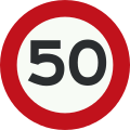 A1: Speed limit (50 kmh)
 A2: End of speed limit (50 km/h)
 A3: Speed limit displayed on an electronic display panel
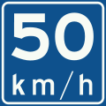 A4: Recommended speed
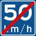 A5: End of recommended speed
Priority
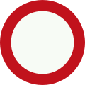
 B1: Priority road
 B2: End of priority road
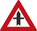 B3: Crossroads with priority
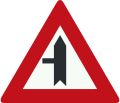 B4: Road junction with priority over minor road from the left
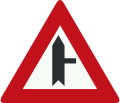 B5: Road junction with priority over minor road from the right
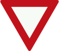 B6: Give priority to traffic on the main road ahead
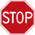 B7: Stop: Give priority to traffic on the main road ahead
Road closed warnings
 C1: Road closed in both directions to vehicles, riders and persons in charge of animals or livestock
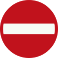 C2: No entry in this direction for vehicular traffic, horse riders and persons in charge of animals or livestock
 C3: One-way road
.svg.png) C4: One-way road
C4: One-way road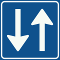 C5: Access permitted for both sides
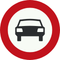 C6: No access for vehicles with more than two wheels
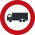 C7: No access for goods vehicles
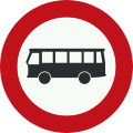 C7a: Closed to buses
 C7b: Closed to buses and lorries
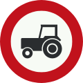 C8: No access for motor vehicles that cannot exceed 25 km/h
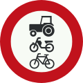 C9: No access for riders, cattle, wagons, motor vehicles not able to exceed a speed of 25 km/h, microcars, bicycles, mopeds or invalid carriages
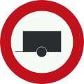 C10: No access for motor vehicle towing trailers
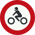 C11: No access for motor cycles
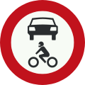 C12: No access for motor vehicles
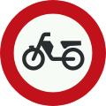 C13: No access for mopeds, motor-assisted bicycles or motor-powered invalid carriages
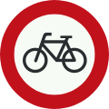 C14: No access for bicycles or for non-motor-powered invalid carriages
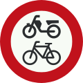 C15: No access for bicycles, mopeds and invalid carriages
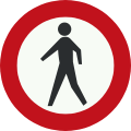 C16: No access for pedestrians
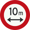 C17: No access for vehicles or combinations of vehicles with a length, including the load, greater than indicated
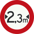 C18: No access for vehicles with a width, including the load, greater than indicated
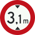 C19: No access for vehicles with a height, including the load, greater than indicated
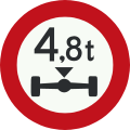 C20: No access for vehicles with an axle load greater than indicated
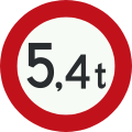 C21: No access for vehicles or combinations of vehicles with a total weight greater than indicated
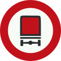 C22: No access for vehicles carrying hazardous substances
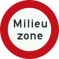 C22a: Environmental zone: no access for vehicles not compliant with article 86d of RVV 1990
 C22b: End of environmental zone
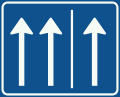 C23-01: Rush-hour lane open
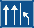 C23-02: Clear rush-hour lane
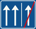 C23-03: Rush-hour lane closed
Signs giving positive instructions
 D1: Roundabout – give way to vehicles on the immediate left
 D2: Instruction to all drivers to keep to the right of the sign (or left if arrow is reversed)
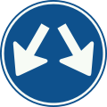 D3: The sign may be passed on either side
 D4: Instruction to drive ahead only
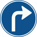 D5: Instruction to follow the direction ahead shown by the arrow
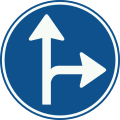 D6: Instruction to follow one of the directions ahead shown by the arrows
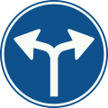 D7: Instruction to follow one of the directions ahead shown by the arrows
Parking and stopping
 E1: No parking
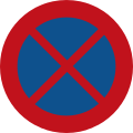 E2: No stopping
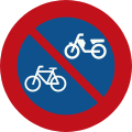 E3: No parking bicycles or mopeds
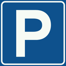 E4: Parking area
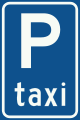 E5: Taxi rank
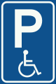 E6: Parking for disabled drivers
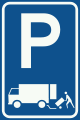 E7: Parking permitted for the immediate loading and unloading of goods only
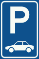 E8: Parking facilities only for the category or group of vehicle shown
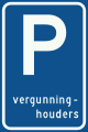 E9: Parking for permit-holders only
 E10: Entrance to controlled parking zone
 E11: End of controlled parking zone
 E12: Park and ride facilities
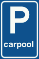 E13: Parking facilities for car sharers
Other signs giving orders
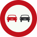 F1: No overtaking
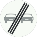 F2: End of no overtaking zone
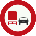 F3: No overtaking of cars by lorries
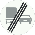 F4: End of zone with no overtaking of cars by lorries
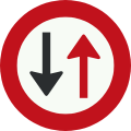 F5: Give way to oncoming vehicles
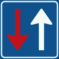 F6: Priority over oncoming vehicles
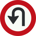 F7: No U-turns
 F8: End of all restrictions imposed by traffic signs
 F9: End of all restrictions imposed by electronic signalling panels
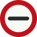 F10: Stop. The sign can also contain further information as to whom it is directed and why
Traffic regulations
 G1: Motorway
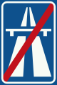 G2: End of motorway
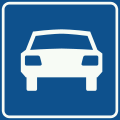 G3: Expressway
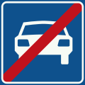 G4: End of Expressway
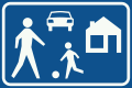 G5: Living street
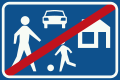 G6: End of Living street
 G7: Footpath
 G8: End of footpath
 G9: Bridleway
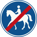 G10: End of bridleway
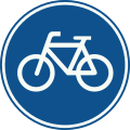 G11: Route for pedal cycles only
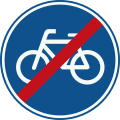 G12: End of pedal cycles route
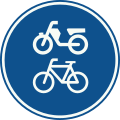 G12a: Route for pedal cycle and mopeds only
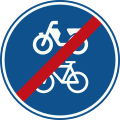 G12b: End of route for pedal cycles and mopeds
 G13: Optional cycle path
 G14: End of optional cycle path
Built-up area
 H1: Built-up area
 H2: End of built-up area
Warning
 J1: Uneven road
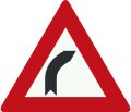 J2: Bend to right
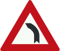 J3: Bend to left
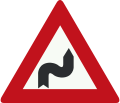 J4: Double bend, first to right
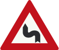 J5: Double bend, first to left
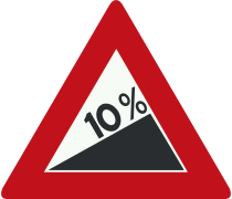 J6: Steep hill upward
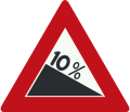 J7: Steep hill downward
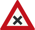 J8: Dangerous crossing
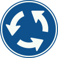
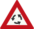 J9: Roundabout
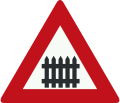 J10: Level crossing with barrier or gates ahead
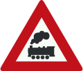 J11: Level crossing without barrier or gates ahead
 J12: Level crossing with single track
 J13: Level crossing with two or more tracks
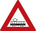 J14: Tram (crossing) ahead
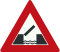 J15: Opening or swing bridge ahead
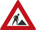 J16: Road works ahead
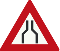 J17: Road narrows on both sides
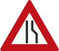 J18: Road narrows on the right side
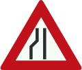 J19: Road narrows on the left side
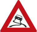 J20: Slippery road
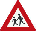 J21: School crossing
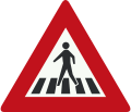 J22: Pedestrian crossing
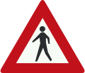 J23: Pedestrians
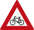 J24: Cyclists and moped riders
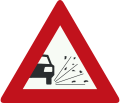 J25: Loose chippings
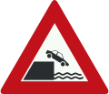 J26: Quayside or river bank
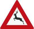 J27: Wild animals
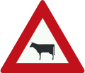 J28: Livestock
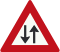 J29: Two-way traffic
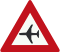 J30: Low-flying aircraft
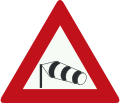 J31: Side winds
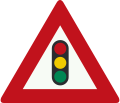 J32: Traffic lights
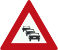 J33: Queues likely
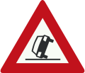 J34: Danger of accidents
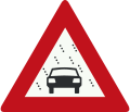 J35: Reduced visibility because of snow, rain or fog
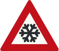 J36: Risk of ice or snow
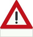 J37: Danger. Details of the danger are shown on the plate beneath
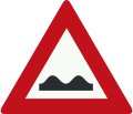
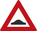 J38: Speed bump
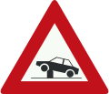 J39: Warning for retractable bollard (poller) in the traffic lane that can be used to regulate access to streets and areas.
Direction
 K1: Low level motorway information sign showing both main and intermediary destinations and the motorway number (old)
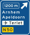 K2: Advance warning sign of a motorway showing the distance to the next exit and destinations after the exit (the top destination is the name of the exit), direction to aerodrome/airport and the road number (non-motorway)(old)
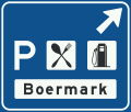 K3: Information sign for exit to motorway service area, showing the name of the rest area and symbols for the services offered (old)
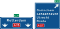 K4: High level motorway information sign showing lane instructions for through traffic and exit panel showing intermediary destinations, with the motorway number and European route numbers (old)
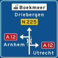 K5: Non-motorway advance information panel showing intermediary destinations, road numbers, a viaduct symbol and a sign for an industrial zone
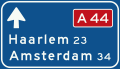
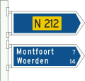 K6: Non-motorway information panels showing intermediary destinations and non-motorway road numbers
 K7: Signposts for cyclists and moped riders (finger posts) showing local and intermediary destinations, municipal cycle route numbers (above) and showing intermediary destinations and intermediary cycle route numbers (below)
 K8: Signposts (multiple) for cyclists and moped riders showing intermediary destinations and indicating an alternative route (in italics) to one of the destinations
 K9: Diversion with alternative route shown on an advance warning panel for a non-motorway highway
 K10: Advance warning panel within a built-up area showing an intermediary destination, local destinations, local tourist sights, local facilities and road numbers through the town
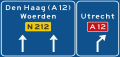 K11: Lane instructions on a non-motorway highway. Panel showing intermediary destinations, road numbers and directions to a motorway
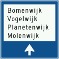 K12: Local signpost within a built-up area showing names of individual districts (in traffic areas)
 K13: Signpost within a built-up area showing district numbers (in traffic areas)
 K14: Route for the conveyance of hazardous materials
Information
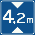 L1: No vehicles over height shown
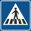
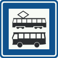 L3a: Tram stop/bus stop
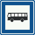 L3b: Bus stop
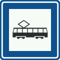 L3c: Tram stop
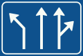 L4: Get in lane
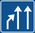 L5: End of lane
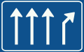 L6: Lane fork
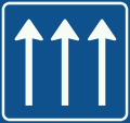 L7: Number of through lanes
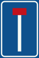 L8: No through road for vehicles
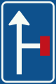 L9: Advance warning of a no through road for vehicles
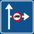 L10: Advance warning of traffic information for the direction shown
 L11: Information on panel applies only to the lane(s) indicated
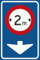 L12: Information on panel applies only to the lane indicated
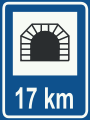 L13: Model sign traffic tunnel
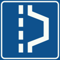 L14: Hard shoulder
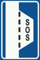 L15: Hard shoulder equipped with emergency telephone and fire extinguisher
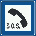 L16: Emergency telephone
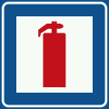 L17: Fire extinguisher
 L18: Emergency telephone and fire extinguisher
.svg.png) L19: Nearest exit or second nearest exits in the directions and at the distances indicated on the sign
L19: Nearest exit or second nearest exits in the directions and at the distances indicated on the sign
Retired versions
.svg.png) B1: Priority road
B1: Priority road.svg.png) B7: Stop: Give priority to traffic on the main road ahead
B7: Stop: Give priority to traffic on the main road ahead.svg.png) J37: Danger
J37: Danger
External links
- Road Traffic Signs and Regulations in the Netherlands
- Official text of the Reglement verkeersregels en verkeerstekens 1990 (Dutch)
- Comprehensive overview of Dutch road signs (Dutch)
This article is issued from Wikipedia - version of the 4/12/2016. The text is available under the Creative Commons Attribution/Share Alike but additional terms may apply for the media files.