Sông Cầu, Bắc Kạn
| Sông Cầu | |
|---|---|
| Urban ward | |
| Country |
|
| Province | Bắc Kạn |
| District | Bắc Kạn |
| Area | |
| • Total | 1.67 sq mi (4.32 km2) |
| Population | |
| • Total | 6,342 |
| • Density | 3,800/sq mi (1,468/km2) |
| Time zone | Indochina Time (UTC+07:00) |
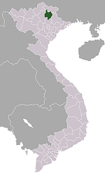
Sông Cầu is an urban ward (phường) of Bắc Kạn, Bắc Kạn Province, in Vietnam.
Coordinates: 13°27′N 109°13′E / 13.450°N 109.217°E
This article is issued from Wikipedia - version of the 12/3/2016. The text is available under the Creative Commons Attribution/Share Alike but additional terms may apply for the media files.