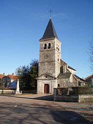
Saint-Broing-les-Moines
| Saint-Broing-les-Moines | ||
|---|---|---|
 | ||
| ||
 Saint-Broing-les-Moines | ||
|
Location within Bourgogne-Franche-Comté region  Saint-Broing-les-Moines | ||
| Coordinates: 47°41′53″N 4°50′33″E / 47.6981°N 4.8425°E / 47.6981; 4.8425Coordinates: 47°41′53″N 4°50′33″E / 47.6981°N 4.8425°E / 47.6981; 4.8425 | ||
| Country | France | |
| Region | Bourgogne-Franche-Comté | |
| Department | Côte-d'Or | |
| Arrondissement | Montbard | |
| Canton | Recey-sur-Ource | |
| Intercommunality | Pays Châtillonnais | |
| Government | ||
| • Mayor (2008–2014) | Jean-Claude Imberdis | |
| Area1 | 20.09 km2 (7.76 sq mi) | |
| Population (2008)2 | 186 | |
| • Density | 9.3/km2 (24/sq mi) | |
| Time zone | CET (UTC+1) | |
| • Summer (DST) | CEST (UTC+2) | |
| INSEE/Postal code | 21543 / 21290 | |
| Elevation |
322–468 m (1,056–1,535 ft) (avg. 390 m or 1,280 ft) | |
|
1 French Land Register data, which excludes lakes, ponds, glaciers > 1 km² (0.386 sq mi or 247 acres) and river estuaries. 2 Population without double counting: residents of multiple communes (e.g., students and military personnel) only counted once. | ||
.svg.png)
Saint-Broing-les-Moines is a commune in the Côte-d'Or department in eastern France.
Population
| Historical population | ||
|---|---|---|
| Year | Pop. | ±% |
| 1962 | 235 | — |
| 1968 | 267 | +13.6% |
| 1975 | 240 | −10.1% |
| 1982 | 260 | +8.3% |
| 1990 | 205 | −21.2% |
| 1999 | 181 | −11.7% |
| 2008 | 186 | +2.8% |
See also
References
| Wikimedia Commons has media related to Saint-Broing-les-Moines. |
This article is issued from Wikipedia - version of the 3/15/2016. The text is available under the Creative Commons Attribution/Share Alike but additional terms may apply for the media files.