Saint-Franc
| Saint-Franc | |
|---|---|
|
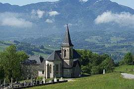
The church in Saint-Franc | |
 Saint-Franc | |
|
Location within Auvergne-Rhône-Alpes region  Saint-Franc | |
| Coordinates: 45°29′32″N 5°44′48″E / 45.4922°N 5.7467°ECoordinates: 45°29′32″N 5°44′48″E / 45.4922°N 5.7467°E | |
| Country | France |
| Region | Auvergne-Rhône-Alpes |
| Department | Savoie |
| Arrondissement | Chambéry |
| Canton | Les Échelles |
| Intercommunality | Mont Beauvoir |
| Government | |
| • Mayor (2008–2014) | Pierre -Auguste Feugier |
| Area1 | 7.25 km2 (2.80 sq mi) |
| Population (2006)2 | 165 |
| • Density | 23/km2 (59/sq mi) |
| Time zone | CET (UTC+1) |
| • Summer (DST) | CEST (UTC+2) |
| INSEE/Postal code | 73233 / 73360 |
| Elevation | 320–725 m (1,050–2,379 ft) |
|
1 French Land Register data, which excludes lakes, ponds, glaciers > 1 km² (0.386 sq mi or 247 acres) and river estuaries. 2 Population without double counting: residents of multiple communes (e.g., students and military personnel) only counted once. | |
Saint-Franc is a commune in the Savoie department in the Auvergne-Rhône-Alpes region in south-eastern France.
See also
References
| Wikimedia Commons has media related to Saint-Franc. |
This article is issued from Wikipedia - version of the 10/28/2016. The text is available under the Creative Commons Attribution/Share Alike but additional terms may apply for the media files.