Sankt Oswald bei Haslach
| Sankt Oswald bei Haslach | ||
|---|---|---|
 | ||
| ||
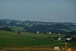
 Sankt Oswald bei Haslach Location within Austria | ||
| Coordinates: 48°37′11″N 14°01′54″E / 48.61972°N 14.03167°ECoordinates: 48°37′11″N 14°01′54″E / 48.61972°N 14.03167°E | ||
| Country | Austria | |
| State | Upper Austria | |
| District | Rohrbach | |
| Government | ||
| • Mayor | Paul Mathe (ÖVP) | |
| Area | ||
| • Total | 8 km2 (3 sq mi) | |
| Elevation | 658 m (2,159 ft) | |
| Population (14 June 2016)[1] | ||
| • Total | 500 | |
| • Density | 63/km2 (160/sq mi) | |
| Time zone | CET (UTC+1) | |
| • Summer (DST) | CEST (UTC+2) | |
| Postal code | 4170 | |
| Area code | 07289 | |
| Vehicle registration | RO | |

Population
| Historical population | ||
|---|---|---|
| Year | Pop. | ±% |
| 1869 | 589 | — |
| 1880 | 614 | +4.2% |
| 1890 | 540 | −12.1% |
| 1900 | 502 | −7.0% |
| 1910 | 447 | −11.0% |
| 1923 | 438 | −2.0% |
| 1934 | 433 | −1.1% |
| 1939 | 417 | −3.7% |
| 1951 | 465 | +11.5% |
| 1961 | 458 | −1.5% |
| 1971 | 491 | +7.2% |
| 1981 | 531 | +8.1% |
| 1991 | 570 | +7.3% |
| 2001 | 567 | −0.5% |
| 2011 | 497 | −12.3% |
References
- ↑ Statistik Austria - Bevölkerung zu Jahresbeginn 2002-2016 nach Gemeinden, Erstellt am 14.06.2016 (Last accessed 13.12.2016) for Sankt Oswald bei Haslach.
| Wikimedia Commons has media related to Sankt Oswald bei Haslach. |
This article is issued from Wikipedia - version of the 12/23/2015. The text is available under the Creative Commons Attribution/Share Alike but additional terms may apply for the media files.