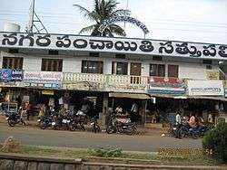
Sathupalli
| Sathupally సత్తుపల్లి | |
|---|---|
| Town | |
 | |
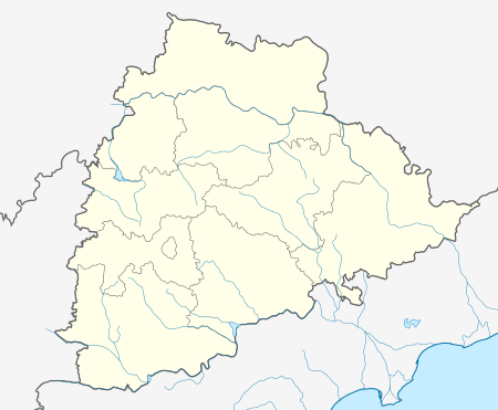 Sathupally  Sathupally Location in Telangana, India | |
| Coordinates: 17°12′30″N 80°50′10″E / 17.20833°N 80.83611°ECoordinates: 17°12′30″N 80°50′10″E / 17.20833°N 80.83611°E | |
| Country |
|
| State | Telangana |
| District | Khammam |
| Government | |
| • Body | Municipality |
| Area[1] | |
| • Total | 19.13 km2 (7.39 sq mi) |
| Population (2011)[1] | |
| • Total | 31,857 |
| • Density | 1,700/km2 (4,300/sq mi) |
| Languages | |
| • Official | Telugu |
| Time zone | IST (UTC+5:30) |
| PIN | 507303 |
| Telephone code | 08761 |
| Vehicle registration | TS-04 |
| Lok Sabha constituency | Khammam |
| Vidhan Sabha constituency | Sathupally |
| Website |
telangana |
Sathupallyis a town in Khammam district of the Indian state of Telangana. It is a Nagar panchayat in Sathupalli mandal of Khammam revenue division.[1][2]
Geography
Sathupally is located at 17°13′N 80°49′E / 17.21°N 80.82°E Coordinates.
Transport
As Sathupally town is located on SH 7 it is well connected to major cities and towns in Telangana and Andhra Pradesh. TSRTC operates regular bus services to many cities like Khammam, Hyderabad, Vijayawada, Eluru, Visakhapatnam.
References
- 1 2 3 "District Census Handbook – Khammam" (PDF). Census of India. The Registrar General & Census Commissioner. p. 14,46. Retrieved 1 June 2016.
- ↑ bliccathemes. "Sathupalli Municipality".
| District headquarters | |
|---|---|
| Revenue divisions | |
| Mandals | |
| Cities | |
| Towns |
|
| Census Towns |
|
This article is issued from Wikipedia - version of the 11/4/2016. The text is available under the Creative Commons Attribution/Share Alike but additional terms may apply for the media files.