Sela, Videm
| Sela | |
|---|---|
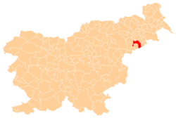
 Sela Location in Slovenia | |
| Coordinates: 46°22′14.06″N 15°49′34.14″E / 46.3705722°N 15.8261500°ECoordinates: 46°22′14.06″N 15°49′34.14″E / 46.3705722°N 15.8261500°E | |
| Country |
|
| Traditional region | Styria |
| Statistical region | Drava |
| Municipality | Videm |
| Area | |
| • Total | 3.04 km2 (1.17 sq mi) |
| Elevation | 230.5 m (756.2 ft) |
| Population (2002) | |
| • Total | 188 |
| [1] | |
Sela (pronounced [ˈseːla]) is a settlement on the left bank of the Polskava River south of Ptuj in eastern Slovenia. It belongs to the Municipality of Videm and forms a more or less continuous settlement together with Barislovci. The area traditionally belonged to the Styria region. It is now included in the Drava Statistical Region.[2]
The local church, dedicated to the Holy Family, although technically in Barislovci, is known locally as the church at Sela. There is also a small chapel-shrine with a belfry at the village crossroads. It was built in 1920.[3]
References
External links
| Settlements | Administrative centre: Videm pri Ptuju
|  |
|---|---|---|
| Landmarks |
| |
This article is issued from Wikipedia - version of the 10/27/2016. The text is available under the Creative Commons Attribution/Share Alike but additional terms may apply for the media files.