Serra do Navio
| Serra do Navio | |
|---|---|
| Municipality | |
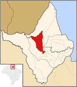 Location in Amapá state | |
 Serra do Navio Location in Brazil | |
| Coordinates: 0°53′45″N 52°0′7″W / 0.89583°N 52.00194°WCoordinates: 0°53′45″N 52°0′7″W / 0.89583°N 52.00194°W | |
| Country |
|
| Region | North Region |
| State | Amapá |
| Area | |
| • Total | 7,713 km2 (2,978 sq mi) |
| Population (2015) | |
| • Total | 4,938 |
| • Density | 0.64/km2 (1.7/sq mi) |
| Time zone | BRT (UTC-3) |
Serra do Navio (Mountain range of the Ship) is a municipality located in the center of the state of Amapá in Brazil. Its population is 4,938 (2015 est.) and its area is 7,713 km².[1]
The municipality contains 7.83% of the 2,369,400 hectares (5,855,000 acres) Amapá State Forest, a sustainable use conservation unit established in 2006.[2]
References
- ↑ "IBGE | Cidades | Amapá | Serra do Navio". cidades.ibge.gov.br. Retrieved 2016-05-17.
- ↑ FES do Amapá (in Portuguese), ISA: Instituto Socioambiental, retrieved 2016-07-06
Capital: Macapá | ||
| Amapá | 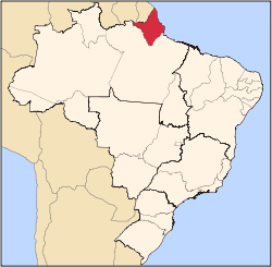 | |
| Macapá | ||
| Mazagão | ||
| Oiapoque | ||
This article is issued from Wikipedia - version of the 7/6/2016. The text is available under the Creative Commons Attribution/Share Alike but additional terms may apply for the media files.