Shawsville, Maryland
| Shawsville, Maryland | |
|---|---|
| Unincorporated community | |
|
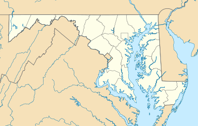
A farm in Shawsville | |
 | |
| Coordinates: 39°38′16″N 76°33′18″W / 39.63778°N 76.55500°WCoordinates: 39°38′16″N 76°33′18″W / 39.63778°N 76.55500°W | |
| Country | United States |
| State | Maryland |
| County | Harford |
| Elevation | 650 ft (200 m) |
| Time zone | Eastern (EST) (UTC-5) |
| • Summer (DST) | EDT (UTC-4) |
| Area code(s) | 410 & 443 |
| GNIS feature ID | 591268[1] |
_just_west_of_Maryland_State_Route_23_(Norrisville_Road)_in_Shawsville%2C_Harford_County%2C_Maryland.jpg)
Shawsville is an unincorporated community in Harford County, Maryland, United States. Shawsville is located on Maryland Route 23 13.1 miles (21.1 km) west-northwest of Bel Air.[2]
References
- ↑ "Shawsville". Geographic Names Information System. United States Geological Survey.
- ↑ Maryland General Highway Statewide Grid Map: Bradenbaugh Map No. A-13C (PDF) (Map). Maryland Department of Transportation. 2012. Retrieved March 8, 2013.
Municipalities and communities of Harford County, Maryland, United States | ||
|---|---|---|
| Cities | 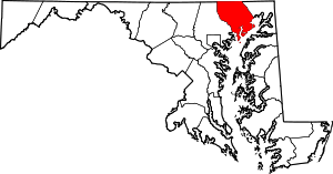 | |
| Town | ||
| CDPs | ||
| Other communities | ||
This article is issued from Wikipedia - version of the 12/4/2016. The text is available under the Creative Commons Attribution/Share Alike but additional terms may apply for the media files.