Sniderville, Wisconsin
| Sniderville, Wisconsin | |
|---|---|
| Unincorporated community | |
 Sniderville  Sniderville | |
| Coordinates: 44°21′06″N 88°11′28″W / 44.35167°N 88.19111°WCoordinates: 44°21′06″N 88°11′28″W / 44.35167°N 88.19111°W | |
| Country | United States |
| State | Wisconsin |
| Counties | Brown, Outagamie |
| Towns | Wrightstown, Kaukauna |
| Elevation | 676 ft (206 m) |
| Time zone | Central (CST) (UTC-6) |
| • Summer (DST) | CDT (UTC-5) |
| Area code(s) | 920 |
| GNIS feature ID | 1577828[1] |
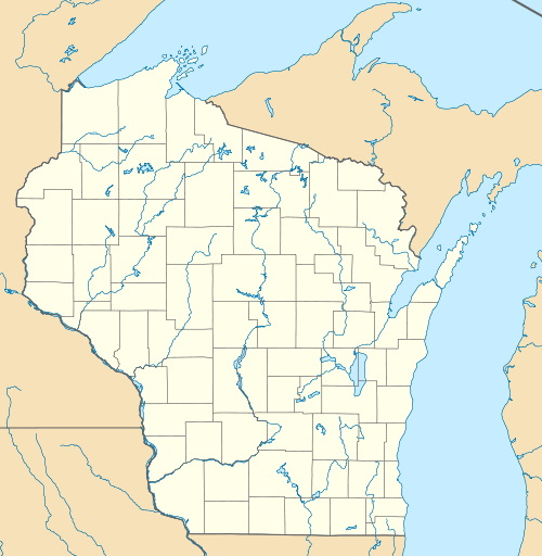
Sniderville is an unincorporated community located in the towns of Wrightstown and Kaukauna in Brown and Outagamie counties, Wisconsin, United States.[1] It is located on U.S. Route 41/Interstate 41 near Brown County Trunk DDD and Brown County Trunk U.[2]
Notes
- 1 2 "Sniderville, Wisconsin". Geographic Names Information System. United States Geological Survey.
- ↑ "Google Maps". Google Maps. Retrieved 2016-10-19.
Municipalities and communities of Brown County, Wisconsin, United States | ||
|---|---|---|
| Cities | 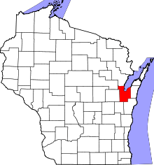 | |
| Villages | ||
| Towns | ||
| CDPs | ||
| Unincorporated communities |
| |
| Indian reservation | ||
| Ghost towns/ neighborhoods | ||
| Footnotes | ‡This populated place also has portions in an adjacent county or counties | |
Municipalities and communities of Outagamie County, Wisconsin, United States | ||
|---|---|---|
| Cities |  | |
| Villages | ||
| Towns | ||
| CDP | ||
| Unincorporated communities | ||
| Indian reservation | ||
| Ghost towns | ||
| Footnotes | ‡This populated place also has portions in an adjacent county or counties | |
This article is issued from Wikipedia - version of the 10/19/2016. The text is available under the Creative Commons Attribution/Share Alike but additional terms may apply for the media files.