Sorell Council
| Sorell Council Tasmania | |||||||||||||
|---|---|---|---|---|---|---|---|---|---|---|---|---|---|
 Sorell Council | |||||||||||||
| Coordinates | 42°45′0″S 147°40′12″E / 42.75000°S 147.67000°ECoordinates: 42°45′0″S 147°40′12″E / 42.75000°S 147.67000°E | ||||||||||||
| Population | 13,955 (2015 est.)[1] | ||||||||||||
| • Density | 23.9530/km2 (62.038/sq mi) | ||||||||||||
| Area | 582.6 km2 (224.9 sq mi) | ||||||||||||
| Mayor | Carmel Torenius | ||||||||||||
| Council seat | Sorell | ||||||||||||
| Region | Sorell and surrounds | ||||||||||||
| State electorate(s) | Lyons | ||||||||||||
| Federal Division(s) | Lyons | ||||||||||||
|
| |||||||||||||
| Website | Sorell Council | ||||||||||||
| |||||||||||||
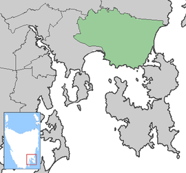
Sorell Council is a local government area of Tasmania, Australia. The municipality of Sorell is one of the fastest growing areas in Tasmania.[2]
Marion Bay, on the council's east coast, is host to the Tasmanian Falls Festival, an annual event first held in Tasmania on New Year's Eve in December 2003.
Suburbs[3]
| Suburb | Census Population 2011 | Reason |
|---|---|---|
| Shark Point | Incl. in Penna | |
| Midway Point | 2598 | |
| Penna | 403 | |
| Sorell | 2476 | |
| Forcett | 635 | |
| Lewisham | 881 | |
| Dodges Ferry | 2319 | |
| Carlton | 1241 | |
| Primrose Sands | 934 | |
| Carlton River | Incl. in Connellys Marsh | |
| Connellys Marsh | 179 | Includes Carlton River |
| Dunalley | 274 | |
| Boomer Bay | 199 | Includes Marion Bay |
| Marion Bay | Incl. in Boomer Bay | |
| Bream Creek | Incl. in Kellevie | |
| Nugent | Incl. in Wattle Hill | |
| Wattle Hill | 334 | Includes Nugent, Pawleena |
| Pawleena | Incl. in Wattle Hill | |
| Orielton | 345 | |
| Copping | Incl. in Kellevie | |
| Kellevie | 417 | Includes Copping, Bream Creek |
| Total | 13325 | |
| (41) | Variance | |
| Local Government Total | 13,194 | Gazetted Sorell Council Local Government Area |
References
- ↑ "3218.0 – Regional Population Growth, Australia, 2014–15". Australian Bureau of Statistics. Retrieved 29 September 2016.
- ↑ "Statewide population change, RPDC". 2005-05-02. Archived from the original on 2006-09-17. Retrieved 2006-11-30.
- ↑ Australian Bureau of Statistics. "2011 Census QuickStats". Retrieved 29 May 2016.
External links
Local government areas of Tasmania grouped by areas | ||
|---|---|---|
| Central | ||
| Hobart area | ||
| Launceston area | ||
| North-east area | ||
| North-west and west coast | ||
| South-east area | ||
East Coast region of Tasmania, Australia | |||||||
|---|---|---|---|---|---|---|---|
| Settlements | |||||||
| Governance former | |||||||
| Mountains | |||||||
| Protected areas, parks and reserves |
| ||||||
| Harbours, bays, inlets and estuaries | |||||||
| Landmarks |
| ||||||
| People of note | |||||||
| Islands |
| ||||||
| Books and newspapers | |||||||
| Flora, fauna, and fishlife | |||||||
| Bioregions | |||||||
| |||||||
This article is issued from Wikipedia - version of the 11/15/2016. The text is available under the Creative Commons Attribution/Share Alike but additional terms may apply for the media files.