South Billings, North Dakota
| South Billings, North Dakota | |
|---|---|
| Unorganized Territory | |
 South Billings, North Dakota Location within the state of North Dakota | |
| Coordinates: 46°45′22″N 103°25′04″W / 46.75611°N 103.41778°W | |
| Country | United States |
| State | North Dakota |
| County | Billings |
| Elevation | 2,631 ft (802 m) |
| Population (2010) | |
| • Total | 204 |
| Time zone | Mountain (MST) (UTC-7) |
| • Summer (DST) | MDT (UTC-6) |
| GNIS feature ID | 1036266[1] |
South Billings is an unorganized territory in Billings County, North Dakota. As of the 2010 census it had a population of 204.[2]
References
- ↑ U.S. Geological Survey Geographic Names Information System: South Billings, North Dakota
- ↑ "Geographic Identifiers: 2010 Demographic Profile Data (G001): South Billings UT, Adams County, North Dakota". U.S. Census Bureau, American Factfinder. Retrieved Aug 13, 2016.
Municipalities and communities of Billings County, North Dakota, United States | ||
|---|---|---|
| City | 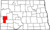 | |
| Unorganized territories | ||
| Unincorporated communities | ||
This article is issued from Wikipedia - version of the 8/14/2016. The text is available under the Creative Commons Attribution/Share Alike but additional terms may apply for the media files.