Spencerville, New Mexico
| Spencerville, New Mexico | |
|---|---|
| Census-designated place | |
 Spencerville, New Mexico | |
| Coordinates: 36°49′09″N 108°03′22″W / 36.81917°N 108.05611°WCoordinates: 36°49′09″N 108°03′22″W / 36.81917°N 108.05611°W | |
| Country | United States |
| State | New Mexico |
| County | San Juan |
| Area[1] | |
| • Total | 3.34 sq mi (8.64 km2) |
| • Land | 3.34 sq mi (8.64 km2) |
| • Water | 0 sq mi (0 km2) |
| Elevation | 5,669 ft (1,728 m) |
| Population (2010)[2] | |
| • Total | 1,258 |
| • Density | 377/sq mi (145.6/km2) |
| Time zone | Mountain (MST) (UTC-7) |
| • Summer (DST) | MDT (UTC-6) |
| GNIS feature ID | 2584133[3] |
Spencerville is a census-designated place in San Juan County, New Mexico, United States. Its population was 1,258 as of the 2010 census.[2]
Geography
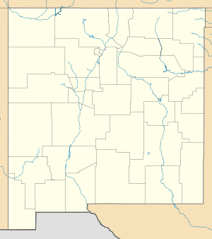
Spencerville is located at coordinates 36°49′09″N 108°03′22″W / 36.81917°N 108.05611°W. According to the United States Census Bureau, Spencerville has a total area of 8.64 square kilometers, all of which is land.[1]
Demographics
According to the 2010 census,[2] 1258 people were living in Spencerville. The population density was 145.6 inhabitants per square kilometer. Of the 1258 inhabitants, Spencerville was composed by 83.23% White, 0.56% were African American, 5.64% were Native American, 0.16% were Asian, 0% were Pacific Islanders, 6.36% were of other races and 4.05 % from two or more races. Of the total population 19.87% were Hispanic or Latino of any race.[4]
References
- 1 2 "2010 Census Gazetteer Files". United States Census Bureau. Retrieved September 19, 2016.
- 1 2 3 "American FactFinder". United States Census Bureau. Retrieved September 19, 2016.
- ↑ "Spencerville". Geographic Names Information System. United States Geological Survey.
- ↑ U.S. Board on Geographic Names
Municipalities and communities of San Juan County, New Mexico, United States | ||
|---|---|---|
| Cities | 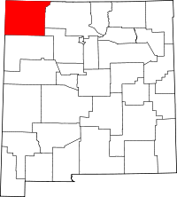 | |
| CDPs |
| |
| Other community | ||
| Indian reservation |
| |
| Footnotes | ‡This populated place also has portions in an adjacent county or counties | |