Springdale Township, Cedar County, Iowa
| Springdale Township, Cedar County | |
|---|---|
| Township | |
 | |
| Coordinates: 41°38′30″N 091°18′29″W / 41.64167°N 91.30806°WCoordinates: 41°38′30″N 091°18′29″W / 41.64167°N 91.30806°W | |
| Country |
|
| State |
|
| County | Cedar |
| Area | |
| • Total | 36.37 sq mi (94.21 km2) |
| • Land | 36.37 sq mi (94.21 km2) |
| • Water | 0 sq mi (0 km2) |
| Elevation[1] | 719 ft (219 m) |
| Population (2000) | |
| • Total | 2,857 |
| • Density | 78.6/sq mi (30.3/km2) |
| FIPS code | 19-93975[2] |
| GNIS feature ID | 0468739 |
Springdale Township is one of seventeen townships in Cedar County, Iowa, USA. As of the 2000 census, its population was 2,857.
History
Springdale Township was established in 1853.[3] Springdale Township was an important point on the Underground Railroad.[4]
Geography
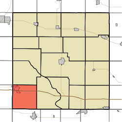
Springdale Township covers an area of 36.37 square miles (94.2 km2) and contains one incorporated settlement, West Branch. According to the USGS, it contains six cemeteries: Chamness, Downey, Hickory Grove, Old Friends, Springdale and West Branch. The unincorporated community of Springdale was historically important in the anti-slavery movement.
References
- ↑ "US Board on Geographic Names". United States Geological Survey. 2007-10-25. Retrieved 2008-01-31.
- ↑ "American FactFinder". United States Census Bureau. Retrieved 2008-01-31.
- ↑ Aurner, Clarence Ray (1910). A Topical History of Cedar County, Iowa, Volume 1. S. J. Clarke. p. 127.
- ↑ The History of Cedar County, Iowa: Containing a History of the County, Its Cities, Towns, etc. Western Historical Company. 1878. p. 518.
External links
Municipalities and communities of Cedar County, Iowa, United States | ||
|---|---|---|
| Cities | ||
| Townships | ||
| CDP | ||
| Other unincorporated communities | ||
| Footnotes | ‡This populated place also has portions in an adjacent county or counties | |
This article is issued from Wikipedia - version of the 11/1/2016. The text is available under the Creative Commons Attribution/Share Alike but additional terms may apply for the media files.