Stac Rhos
| Stac Rhos | |
|---|---|
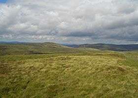 Left to right: Foel y Geifr, Pen y Boncyn Trefeilw, Stac Rhos and Cefn Gwyntog from Moel y Cerrig Duon | |
| Highest point | |
| Elevation | 630 m (2,070 ft) |
| Prominence | 25 m (82 ft) |
| Listing | sub Hewitt, Nuttall |
| Geography | |
| Location | Gwynedd, Wales |
| Parent range | Berwyn range |
| OS grid | SJ071323 |
| Topo map | OS Landranger 125 |
Stac Rhos is a top of Pen y Boncyn Trefeilw in north east Wales. It forms a part of the Berwyn range called the Hirnantau.
The views from the summit are extensive, if unremarkable due to the featureless, flat moorland surroundings. The summit is marked by a small cairn, and a boundary stone. To the east is Cyrniau Nod, while Cefn Gwyntog is to the south-east.[1]
References
- ↑ Nuttall, John & Anne (1999). The Mountains of England & Wales - Volume 1: Wales (2nd edition ed.). Milnthorpe, Cumbria: Cicerone. ISBN 1-85284-304-7.
External links
Coordinates: 52°52′48″N 3°22′55″W / 52.88011°N 3.38191°W
This article is issued from Wikipedia - version of the 1/24/2016. The text is available under the Creative Commons Attribution/Share Alike but additional terms may apply for the media files.