Stanstead-Est, Quebec
| Stanstead-Est | |
|---|---|
| Municipality | |
|
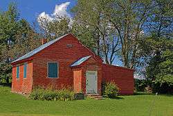
Mansur Rural School in Stanstead-Est | |
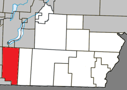 Location within Coaticook RCM. | |
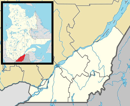 Stanstead Est Location in southern Quebec. | |
| Coordinates: 45°06′N 72°03′W / 45.100°N 72.050°WCoordinates: 45°06′N 72°03′W / 45.100°N 72.050°W[1] | |
| Country |
|
| Province |
|
| Region | Estrie |
| RCM | Coaticook |
| Constituted | July 16, 1932 |
| Government[2] | |
| • Mayor | Guy Lefebvre |
| • Federal riding | Compton—Stanstead |
| • Prov. riding | Saint-François |
| Area[2][3] | |
| • Total | 116.10 km2 (44.83 sq mi) |
| • Land | 113.82 km2 (43.95 sq mi) |
| Population (2011)[3] | |
| • Total | 603 |
| • Density | 5.3/km2 (14/sq mi) |
| • Pop 2006-2011 |
|
| • Dwellings | 322 |
| Time zone | EST (UTC−5) |
| • Summer (DST) | EDT (UTC−4) |
| Postal code(s) | J0B 3E0 |
| Area code(s) | 819 |
| Highways |
|
Stanstead-Est is a municipality in Quebec.
Demographics
Population
Population trend:[4]
| Census | Population | Change (%) |
|---|---|---|
| 2011 | 603 | |
| 2006 | 628 | |
| 2001 | 661 | |
| 1996 | 668 | |
| 1991 | 686 | N/A |
References
- ↑ Reference number 60706 of the Commission de toponymie du Québec (French)
- 1 2 Geographic code 44050 in the official Répertoire des municipalités (French)
- 1 2 "(Code 2444050) Census Profile". 2011 census. Statistics Canada. 2012.
- ↑ Statistics Canada: 1996, 2001, 2006, 2011 census
 |
Magog | Sainte-Catherine-de-Hatley / Ayer's Cliff | Hatley (municipality) | |
| Stanstead (township) Ogden |
|
Barnston-Ouest | ||
| ||||
| | ||||
| Stanstead (town) | Holland, Vermont |
| Cities | |
|---|---|
| Municipalities | |
| Townships | |
| |
This article is issued from Wikipedia - version of the 7/19/2014. The text is available under the Creative Commons Attribution/Share Alike but additional terms may apply for the media files.