State road D555 (Turkey)
| D.555 |
|---|
 |
| Route information |
|---|
Part of 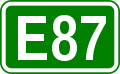 |
| Length: |
156 km (97 mi) |
|---|
| Major junctions |
|---|
| North end: |
Dereköy Checkpoint at the Bulgaria-Turkey border crossing |
|---|
| South end: |
Tekirdağ  junction junction |
|---|
| Highway system |
|---|
|
|
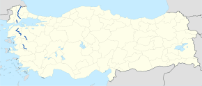
D.555 is a north to south state road running on the Europen part of Turkey. It starts in Dereköy Checkpoint at the Bulgaria-Turkey border crossing and ends in Tekirdağ at the junction. It is part of the European route E87 between its starting point and the  junction in Babaeski, .[1]
Itinerary
Intersections
References
- ↑ Türkiye Haritası (Map) (in Turkish). Karayolları Genel Müdürlüğü. Retrieved 2015-06-18.
External links
 State roads in Turkey |
|---|
|
West–east
highways | Main roads | |
|---|
| Auxiliary roads |
- D.010
- D.020
- D.030
- D.040
- D.050
- D.060
- D.070
- D.080
- D.090
- D.110
- D.120
- D.130
- D.140
- D.150
- D.160
- D.170
- D.180
- D.190
- D.210
- D.220
- D.230
- D.240
- D.250
- D.260
- D.270
- D.280
- D.290
- D.310
- D.320
- D.330
- D.340
- D.350
- D.360
- D.370
- D.380
- D.390
- D.410
- D.420
- D.430
- D.440
- D.450
- D.460
- D.470
- D.480
- D.490
|
|---|
|
|---|
|
North–south
highways | Main roads | |
|---|
| Auxiliary roads |
- D.515
- D.525
- D.535
- D.545
- D.555
- D.565
- D.575
- D.585
- D.595
- D.615
- D.625
- D.635
- D.645
- D.655
- D.665
- D.675
- D.685
- D.695
- D.715
- D.725
- D.735
- D.745
- D.755
- D.765
- D.775
- D.785
- D.795
- D.815
- D.825
- D.835
- D.845
- D.855
- D.865
- D.875
- D.885
- D.895
- D.915
- D.925
- D.935
- D.945
- D.955
- D.965
- D.975
- D.985
- D.995
|
|---|
|
|---|
|
|
 in Pınarhisar