Sulín
| Sulín | |
| Village | |
 | |
| Country | Slovakia |
|---|---|
| Region | Prešov |
| District | Stará Ľubovňa |
| Elevation | 400 m (1,312 ft) |
| Coordinates | 49°22′N 20°45′E / 49.367°N 20.750°ECoordinates: 49°22′N 20°45′E / 49.367°N 20.750°E |
| Area | 20.1 km2 (8 sq mi) |
| Population | 414 (2004-12-31) |
| Density | 21/km2 (54/sq mi) |
| First mentioned | 1960 |
| Postal code | 065 46 |
| Area code | +421-52 |
| Car plate | SL |
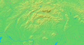  Location of Sulín in Slovakia | |
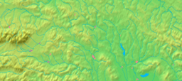  Location of Sulín in the Prešov Region | |
| Statistics: MOŠ/MIS | |
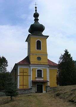
Sulín (Rusyn: Сулин, Sulyn) is a village and municipality in Stará Ľubovňa District in the Prešov Region of northern Slovakia.
History
In historical records the village was first mentioned in 1960.
A more detailed history with photographs can be found at....
Sulín - The Carpathian Connection
Geography
The municipality lies at an altitude of 400 metres and covers an area of 20.098 km². It has a population of about 414 people.
This article is issued from Wikipedia - version of the 10/3/2016. The text is available under the Creative Commons Attribution/Share Alike but additional terms may apply for the media files.