Tabango, Leyte
| Tabango | |
|---|---|
| Municipality | |
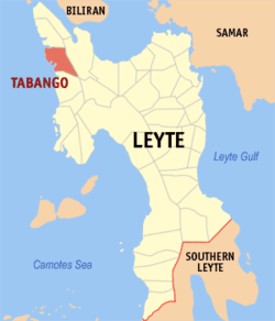 Map of Leyte with Tabango highlighted | |
.svg.png) Tabango Location within the Philippines | |
| Coordinates: 11°19′N 124°22′E / 11.317°N 124.367°ECoordinates: 11°19′N 124°22′E / 11.317°N 124.367°E | |
| Country | Philippines |
| Region | Eastern Visayas (Region VIII) |
| Province | Leyte |
| Congr. district | 3rd district of Leyte |
| Barangays | 13 |
| Area[1] | |
| • Total | 96.62 km2 (37.31 sq mi) |
| Population (2010)[2] | |
| • Total | 31,932 |
| • Density | 330/km2 (860/sq mi) |
| Time zone | PST (UTC+8) |
| ZIP code | 6536 |
| Dialing code | 53 |
Tabango is a fourth class municipality in the province of Leyte, Philippines. According to the 2010 census, it has a population of 31,932 people.[2]
Tabango, with annual income of P 34 million, has 13 barangays (villages), with 26 elementary schools, 4 high schools and one satellite school, the Palompon Institute of Technology.
Barangays
Tabango is politically subdivided into 13 barangays.[1]
- Butason I
- Butason II
- Campokpok
- Catmon
- Gimarco
- Gibacungan
- Inangatan
- Manlawaan
- Omaganhan
- Poblacion
- Santa Rosa
- Tabing
- Tugas
History
In 1957 the sitios of Gibacungan, Catmon and Manlawa-an were converted into barrios.[3]
On January 17, 2008, Tabango Mayor Bernard Jonathan Remandaban opened (soft) the almost complete P 5.8 million modern, fully air-conditioned library: “It took us 6 years to construct our municipal library.” The library can accommodate 20,000 books, has 5 computer units with Internet access and a flat television set that only carries the National Geographic and Discovery Channels. Students can use the computers for 10 hours monthly, free of charge.[4]
Demographics
| Population census of Tabango | ||
|---|---|---|
| Year | Pop. | ±% p.a. |
| 1990 | 29,743 | — |
| 1995 | 31,837 | +1.28% |
| 2000 | 31,433 | −0.27% |
| 2007 | 30,503 | −0.41% |
| 2010 | 31,932 | +1.68% |
| Source: National Statistics Office[2] | ||
References
- 1 2 "Province: Leyte". PSGC Interactive. Makati City, Philippines: National Statistical Coordination Board. Retrieved 13 June 2013.
- 1 2 3 "Total Population by Province, City, Municipality and Barangay: as of May 1, 2010" (PDF). 2010 Census of Population and Housing. National Statistics Office. Retrieved 13 June 2013.
- ↑ "An Act Creating Certain Barrios in the Municipality of Tabango, Province of Leyte". LawPH.com. Retrieved 2011-04-12.
- ↑ Inquirer.net, Poor town has modern library
External links
- Philippine Standard Geographic Code
- Philippine Census Information
- Local Governance Performance Management System
 |
San Isidro | | ||
| Visayan Sea | |
Leyte | ||
| ||||
| | ||||
| Villaba |
Tacloban (capital) | |
| Municipalities |
|
| Component city | |
| Independent component city |
|
| Highly urbanized city |
|