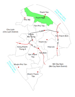
Thạnh Ngãi
| Thạnh Ngãi Xã Thạnh Ngãi | |
|---|---|
| Commune and village | |
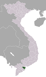
 Location in Mỏ Cày Bắc District | |
 Thạnh Ngãi Location in Mỏ Cày Bắc District | |
| Coordinates: VN 10°14′13″N 106°17′16″E / 10.23694°N 106.28778°E | |
| Country |
|
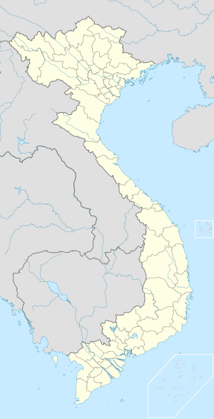
| Region | Mekong Delta |
| Province | Bến Tre |
| District | Mỏ Cày Bắc |
| Area | |
| • Total | 4.40 sq mi (11.39 km2) |
| Population (1999) | |
| • Total | 8,887 |
| • Density | 2,000/sq mi (780/km2) |
| Time zone | Indochina Time (UTC+07:00) |
| Postal code | 28909 |
Thạnh Ngãi is a rural commune of Mỏ Cày Bắc District, Bến Tre Province, Vietnam. The commune covers 11.39 km². In 1999 it had a population of 8,887 and a population density of 780 inhabitants/km².[1]
References
- ↑ "List of populated places in Vietnam". Ministry of Information and Communications of Vietnam. Retrieved 2012-08-30.
Capital: Bến Tre | ||
| Bến Tre |
|  |
| Ba Tri |
| |
| Bình Đại | ||
| Châu Thành |
| |
| Chợ Lách | ||
| Giồng Trôm | ||
| Mỏ Cày Bắc | ||
| Mỏ Cày Nam |
| |
| Thạnh Phú |
| |
This article is issued from Wikipedia - version of the 6/20/2014. The text is available under the Creative Commons Attribution/Share Alike but additional terms may apply for the media files.