Uíge Airport
| Uíge Airport Carmona Airport | |||||||||||
|---|---|---|---|---|---|---|---|---|---|---|---|
| IATA: UGO – ICAO: FNUG | |||||||||||
| Summary | |||||||||||
| Airport type | Public | ||||||||||
| Operator | Government | ||||||||||
| Location | Uíge, Angola | ||||||||||
| Elevation AMSL | 2,720 ft / 829 m | ||||||||||
| Coordinates | 7°36′10″S 15°1′40″E / 7.60278°S 15.02778°ECoordinates: 7°36′10″S 15°1′40″E / 7.60278°S 15.02778°E | ||||||||||
| Map | |||||||||||
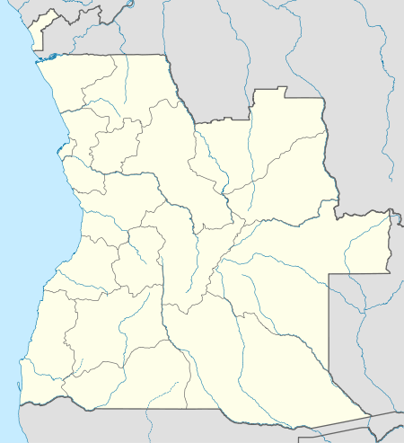 FNUG Location of Uíge/Carmona Airport in Angola | |||||||||||
| Runways | |||||||||||
| |||||||||||
Uíge/Carmona Airport (IATA: UGO, ICAO: FNUG) is a public use airport on the west side of Uíge, the capital of Uíge Province in Angola.
The runway additionally has a 65 metres (213 ft) displaced threshold on each end.
The Uíge non-directional beacon (Ident: UG) is located 2.2 nautical miles south of the runway.[5]
See also
 Angola portal
 Aviation portal
- List of airports in Angola
- Transport in Angola
References
- ↑ Airport information for FNUG at World Aero Data. Data current as of October 2006.
- ↑ Airport information for UGO at Great Circle Mapper.
- ↑ "FNUG @ aerobaticsweb.org". Landings.com. Retrieved 2013-08-01.
- ↑ Google Maps - Uíge
- ↑ UG NDB
External links
This article is issued from Wikipedia - version of the 12/4/2016. The text is available under the Creative Commons Attribution/Share Alike but additional terms may apply for the media files.