Zamušani
| Zamušani | |
|---|---|
 Zamušani Location in Slovenia | |
| Coordinates: 46°25′12.53″N 16°1′28.44″E / 46.4201472°N 16.0245667°ECoordinates: 46°25′12.53″N 16°1′28.44″E / 46.4201472°N 16.0245667°E | |
| Country |
|
| Traditional region | Styria |
| Statistical region | Drava |
| Municipality | Gorišnica |
| Area | |
| • Total | 3.49 km2 (1.35 sq mi) |
| Elevation | 209.2 m (686.4 ft) |
| Population (2002) | |
| • Total | 472 |
| [1] | |
Zamušani (pronounced [ˈzaːmuʃani]) is a settlement in the Municipality of Gorišnica in northeastern Slovenia. The area traditionally belonged to the Styria region. It is now included in the Drava Statistical Region.[2]
There is a T-shaped Neo-Gothic chapel-shrine in the settlement. It was built in 1929.[3]
The railway line from Pragersko to Čakovec runs through the settlement.
References
- ↑ Statistical Office of the Republic of Slovenia Archived November 18, 2008, at the Wayback Machine.
- ↑ Gorišnica municipal site
- ↑ Slovenian Ministry of Culture register of national heritage Archived July 12, 2010, at the Wayback Machine. reference numbers 21123
External links
| Settlements | 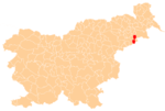 | |
|---|---|---|
| Landmarks |
| |
This article is issued from Wikipedia - version of the 11/15/2016. The text is available under the Creative Commons Attribution/Share Alike but additional terms may apply for the media files.