Ørsdalsvatnet
| Ørsdalsvatnet | |
|---|---|
| Ørdalsvatnet | |
| Location | Bjerkreim, Rogaland |
| Coordinates | 58°37′04″N 6°11′43″E / 58.6179°N 06.1954°E / 58.6179; 06.1954Coordinates: 58°37′04″N 6°11′43″E / 58.6179°N 06.1954°E / 58.6179; 06.1954 |
| Primary outflows | Oreåna river |
| Basin countries | Norway |
| Max. length | 15 kilometres (9.3 mi) |
| Max. width | 1 kilometre (0.62 mi) |
| Surface area | 12.22 km2 (4.72 sq mi) |
| Shore length1 | 36.52 kilometres (22.69 mi) |
| Surface elevation | 63 metres (207 ft) |
| References | NVE |
| 1 Shore length is not a well-defined measure. | |
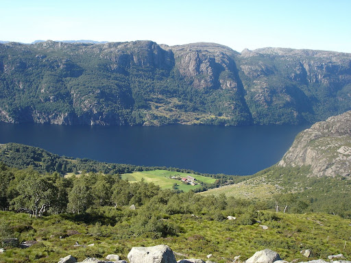
Ørsdalsvatnet or Ørdalsvatnet is a lake in the municipality of Bjerkreim in Rogaland county, Norway.[1] The 12.22-square-kilometre (4.72 sq mi) lake lies about 2 kilometres (1.2 mi) northeast of the village of Bjerkreim. The lake is rather narrow, but it is 15 kilometres (9.3 mi) long.
See also
References
- ↑ "Ørsdalsvatnet, Bjerkreim (Rogaland)" (in Norwegian). yr.no. Retrieved 2016-05-01.
External links
This article is issued from Wikipedia - version of the 6/27/2016. The text is available under the Creative Commons Attribution/Share Alike but additional terms may apply for the media files.