Alberta Highway 45
| ||||
|---|---|---|---|---|
 | ||||
| Route information | ||||
| Length: | 231 km (144 mi) | |||
| Major junctions | ||||
| West end: |
| |||
|
| ||||
| East end: |
Saskatchewan border continues as | |||
| Location | ||||
| Specialized and rural municipalities: | Lamont County, County of Two Hills No. 21, County of Vermilion River | |||
| Towns: | Bruderheim, Two Hills | |||
| Villages: | Willingdon, Myrnam, Marwayne | |||
| Highway system | ||||
|
Provincial highways in Alberta
| ||||

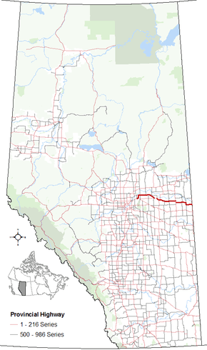
Alberta Provincial Highway No. 45[1] is an east-west highway in central Alberta, Canada. It extends from Highway 15 northeast of Edmonton to the Saskatchewan border. It runs generally parallel to Highway 16 (Yellowhead Highway).
Major intersections
From west to east:[2]
References
- ↑ Provincial Highways Designation Order, Alberta Transportation, p. 8
- ↑ Alberta Road Atlas (2005 ed.). Oshawa, ON: MapArt Publishing Corp. pp. 57-59.
- ↑ "Highway 45" (Map). Google Maps. Google. Retrieved November 17, 2016.
External links
- 2010 Provincial Highways 1 - 216 Series Progress Chart (map, 8 MB) by Alberta Transportation.
This article is issued from Wikipedia - version of the 12/1/2016. The text is available under the Creative Commons Attribution/Share Alike but additional terms may apply for the media files.