Alberta Highway 54
| ||||
|---|---|---|---|---|
 | ||||
| Route information | ||||
| Length: | 70.0 km (43.5 mi) | |||
| Major junctions | ||||
| West end: |
| |||
| East end: |
| |||
| Location | ||||
| Specialized and rural municipalities: | Clearwater County, Red Deer County | |||
| Towns: | Innisfail | |||
| Villages: | Caroline | |||
| Highway system | ||||
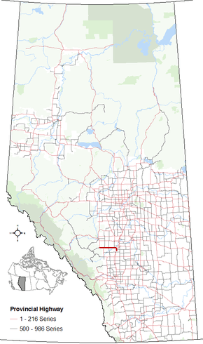
|
Provincial highways in Alberta
| ||||

Alberta Provincial Highway No. 54[1] is an east–west highway located in central Alberta. It is 70 km (43 mi) in length, starting at Highway 22 (Cowboy Trail) 8 km (5.0 mi) west of the Village of Caroline and ending at Exit 365 of Highway 2 (Queen Elizabeth II Highway) at the south end of the Town of Innisfail.[2]
Major intersections
From west to east:[3]
| Rural/specialized municipality | Location | km | mi | Destinations | Notes |
|---|---|---|---|---|---|
| Clearwater County | | 0 | 0.0 | Hwy 22 concurrency begins | |
| | 0.2 | 0.12 | Crosses the Clearwater River | ||
| Caroline | 8 | 5.0 | 50 Street | ||
| | 13 | 8.1 | Hwy 22 concurrency ends | ||
| | 16 | 9.9 | |||
| Red Deer County | | 33 | 21 | ||
| Spruce View | 38 | 24 | Urban Approach Road 114 north – Dickson | ||
| | 50 | 31 | Crosses Medicine River | ||
| | 52 | 32 | |||
| | 61 | 38 | Crosses Red Deer River | ||
| Innisfail | 65 | 40 | Lakewood Drive to | Former Hwy 54 alignment | |
| 69 | 43 | Interchange Hwy 54 ends | |||
1.000 mi = 1.609 km; 1.000 km = 0.621 mi
| |||||
References
- ↑ Provincial Highways Designation Order, Alberta Transportation, p. 8
- ↑ "2010 Provincial Highways 1 - 216 Progress Chart (map, 8 MB)" (PDF). Alberta Transportation. 2010. Retrieved 2010-12-31.
- ↑ Alberta Road Atlas (2005 ed.). Oshawa, ON: MapArt Publishing Corp. pp. 69 and 70.
- Rand McNally British Columbia/Alberta Road Atlas. ISBN 0-88640-682-X. Page 48.
External links
- 2010 Provincial Highways 1 - 216 Series Progress Chart (map, 8 MB) by Alberta Transportation.
This article is issued from Wikipedia - version of the 10/28/2016. The text is available under the Creative Commons Attribution/Share Alike but additional terms may apply for the media files.