Fehring
| Fehring | ||
|---|---|---|
 | ||
| ||
 Fehring Location within Austria | ||
| Coordinates: 46°56′00″N 16°01′00″E / 46.93333°N 16.01667°ECoordinates: 46°56′00″N 16°01′00″E / 46.93333°N 16.01667°E | ||
| Country | Austria | |
| State | Styria | |
| District | Südoststeiermark | |
| Government | ||
| • Mayor | Johann Winkelmaier (ÖVP) | |
| Area | ||
| • Total | 29.61 km2 (11.43 sq mi) | |
| Elevation | 272 m (892 ft) | |
| Population (1 January 2016)[1] | ||
| • Total | 3,039 | |
| • Density | 100/km2 (270/sq mi) | |
| Time zone | CET (UTC+1) | |
| • Summer (DST) | CEST (UTC+2) | |
| Postal code | 8350 | |
| Area codes | +43 3155 | |
| Vehicle registration | FB | |
| Website | www.fehring.at | |
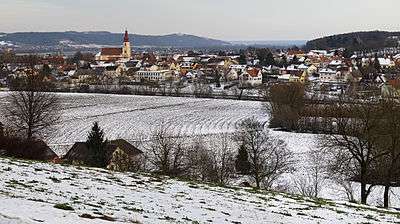

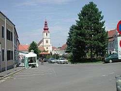
Fehring is a municipality in the district of Südoststeiermark in Styria, Austria. The landscape is rolling hills cut by the valley of the Raab. Fehring is on a socket some metres above the valley floor. The town is bordered to the east by Burgenland.
Neighbouring municipalities
- in the North: Johnsdorf-Brunn and Hohenbrugg-Weinberg
- in the East: Sankt Martin an der Raab and Mühldorf
- in the South: Kapfenstein
- in the West: Pertlstein
Community structure
The municipality Fehring consists of the villages Hirtzenrigel, Höflach, Petzelsdorf, Petersdorf and Schiefer .
History
The first mention of Fehring is with 40 homesteads in a document from Ottokar of 1265th. The district Petzelsdorf is already mentioned in the Babenberger Urbar 1220th. Fehring was founded as a marketplace and Rudolf IV, Duke of Austria awarded the market law. A parish is documented in Fehring since 1305.
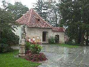
There has been a lot of wars and fights around Fehring, therefore a Tabor was built in the 15th century.
coat of arms: King Ferdinand granted arms in Augsburg at 8 July 1550.
Twin towns
References
- ↑ Statistik Austria - Bevölkerung zu Jahresbeginn 2002-2016 nach Gemeinden (Gebietsstand 2016-01-01), 2016-01-01.