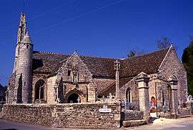
Lanloup
| Lanloup Sant-Loup | ||
|---|---|---|
 | ||
| ||
 Lanloup | ||
|
Location within Brittany region 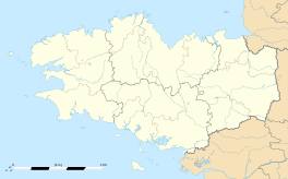 Lanloup | ||
| Coordinates: 48°42′48″N 2°57′51″W / 48.7133°N 2.9642°WCoordinates: 48°42′48″N 2°57′51″W / 48.7133°N 2.9642°W | ||
| Country | France | |
| Region | Brittany | |
| Department | Côtes-d'Armor | |
| Arrondissement | Saint-Brieuc | |
| Canton | Plouha | |
| Intercommunality | Paimpol-Goëlo | |
| Government | ||
| • Mayor (2014–2020) | Yannick Le Bars | |
| Area1 | 2.45 km2 (0.95 sq mi) | |
| Population (2008)2 | 276 | |
| • Density | 110/km2 (290/sq mi) | |
| Time zone | CET (UTC+1) | |
| • Summer (DST) | CEST (UTC+2) | |
| INSEE/Postal code | 22109 / 22580 | |
| Elevation | 35–97 m (115–318 ft) | |
|
1 French Land Register data, which excludes lakes, ponds, glaciers > 1 km² (0.386 sq mi or 247 acres) and river estuaries. 2 Population without double counting: residents of multiple communes (e.g., students and military personnel) only counted once. | ||
.svg.png)
Lanloup (Breton: Sant-Loup) is a commune in the Côtes-d'Armor department of Brittany in northwestern France.
Population
| Historical population | ||
|---|---|---|
| Year | Pop. | ±% |
| 1962 | 331 | — |
| 1968 | 284 | −14.2% |
| 1975 | 236 | −16.9% |
| 1982 | 209 | −11.4% |
| 1990 | 195 | −6.7% |
| 1999 | 214 | +9.7% |
| 2008 | 276 | +29.0% |
Inhabitants of Lanloup are called lanloupais in French.
See also
References
External links
| Wikimedia Commons has media related to Lanloup. |
This article is issued from Wikipedia - version of the 11/9/2014. The text is available under the Creative Commons Attribution/Share Alike but additional terms may apply for the media files.