Plouagat
| Plouagat Plagad | ||
|---|---|---|
|
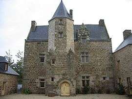
Manor house of Fournebello | ||
| ||
 Plouagat | ||
|
Location within Brittany region 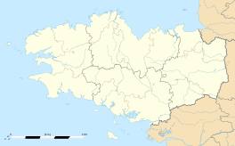 Plouagat | ||
| Coordinates: 48°32′15″N 2°59′51″W / 48.5375°N 2.9975°WCoordinates: 48°32′15″N 2°59′51″W / 48.5375°N 2.9975°W | ||
| Country | France | |
| Region | Brittany | |
| Department | Côtes-d'Armor | |
| Arrondissement | Guingamp | |
| Canton | Plouagat | |
| Intercommunality | Pays de Châtelaudren–Plouagat | |
| Government | ||
| • Mayor (2014–2020) | Olivier Boissière | |
| Area1 | 31.98 km2 (12.35 sq mi) | |
| Population (2008)2 | 2,436 | |
| • Density | 76/km2 (200/sq mi) | |
| Time zone | CET (UTC+1) | |
| • Summer (DST) | CEST (UTC+2) | |
| INSEE/Postal code | 22206 / 22170 | |
| Elevation | 68–262 m (223–860 ft) | |
|
1 French Land Register data, which excludes lakes, ponds, glaciers > 1 km² (0.386 sq mi or 247 acres) and river estuaries. 2 Population without double counting: residents of multiple communes (e.g., students and military personnel) only counted once. | ||
.svg.png)
Plouagat (Breton: Plagad, Gallo: Plagat) is a commune in the Côtes-d'Armor department of Brittany in northwestern France.
Population
| Historical population | ||
|---|---|---|
| Year | Pop. | ±% |
| 1962 | 1,522 | — |
| 1968 | 1,472 | −3.3% |
| 1975 | 1,727 | +17.3% |
| 1982 | 1,978 | +14.5% |
| 1990 | 2,154 | +8.9% |
| 1999 | 2,218 | +3.0% |
| 2008 | 2,436 | +9.8% |
Inhabitants of Plouagat are called plouagatins in French.
See also
References
External links
| Wikimedia Commons has media related to Plouagat. |
This article is issued from Wikipedia - version of the 11/9/2014. The text is available under the Creative Commons Attribution/Share Alike but additional terms may apply for the media files.