Laussa
| Laussa | ||
|---|---|---|
|
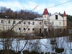
Kogl palace | ||
| ||
 Laussa Location within Austria | ||
| Coordinates: 47°57′01″N 14°27′02″E / 47.95028°N 14.45056°ECoordinates: 47°57′01″N 14°27′02″E / 47.95028°N 14.45056°E | ||
| Country | Austria | |
| State | Upper Austria | |
| District | Steyr-Land | |
| Government | ||
| • Mayor | Josef Gsöllpointner (ÖVP) | |
| Area | ||
| • Total | 34 km2 (13 sq mi) | |
| Elevation | 431 m (1,414 ft) | |
| Population (14 June 2016)[1] | ||
| • Total | 1,250 | |
| • Density | 37/km2 (95/sq mi) | |
| Time zone | CET (UTC+1) | |
| • Summer (DST) | CEST (UTC+2) | |
| Postal code | 4461 | |
| Area code | 07255 | |
| Vehicle registration | SE | |
| Website | www.laussa.at | |

Laussa is a municipality in the district of Steyr-Land in the Austrian state of Upper Austria.
Geography
Laussa lies in the Traunviertel. About 36 percent of the municipality is forest, and 58 percent is farmland.
References
| Wikimedia Commons has media related to Laussa. |
This article is issued from Wikipedia - version of the 3/6/2014. The text is available under the Creative Commons Attribution/Share Alike but additional terms may apply for the media files.