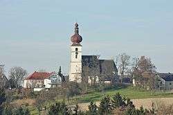
Waldneukirchen
| Waldneukirchen | ||
|---|---|---|
 | ||
| ||
 Waldneukirchen Location within Austria | ||
| Coordinates: 47°59′49″N 14°15′41″E / 47.99694°N 14.26139°ECoordinates: 47°59′49″N 14°15′41″E / 47.99694°N 14.26139°E | ||
| Country | Austria | |
| State | Upper Austria | |
| District | Steyr-Land | |
| Government | ||
| • Mayor | Manfred Freudenthaler (ÖVP) | |
| Area | ||
| • Total | 26 km2 (10 sq mi) | |
| Elevation | 446 m (1,463 ft) | |
| Population (14 June 2016)[1] | ||
| • Total | 2,237 | |
| • Density | 86/km2 (220/sq mi) | |
| Time zone | CET (UTC+1) | |
| • Summer (DST) | CEST (UTC+2) | |
| Postal code | 4595 | |
| Area code | 07258 | |
| Vehicle registration | SE | |
| Website | www.waldneukirchen.at | |

Waldneukirchen is a municipality in the district of Steyr-Land in the Austrian state of Upper Austria.
Geography
About 15 percent of the municipality is forest, and 74 percent is farmland.
References
| Wikimedia Commons has media related to Waldneukirchen. |
This article is issued from Wikipedia - version of the 6/21/2015. The text is available under the Creative Commons Attribution/Share Alike but additional terms may apply for the media files.