Mähring
| Mähring | ||
|---|---|---|
|
Saint Anne Church | ||
| ||
 Mähring | ||
Location of Mähring within Tirschenreuth district 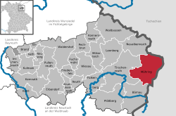 | ||
| Coordinates: 49°55′N 12°31′E / 49.917°N 12.517°ECoordinates: 49°55′N 12°31′E / 49.917°N 12.517°E | ||
| Country | Germany | |
| State | Bavaria | |
| Admin. region | Oberpfalz | |
| District | Tirschenreuth | |
| Government | ||
| • Mayor | Josef Schmidkonz | |
| Area | ||
| • Total | 72.94 km2 (28.16 sq mi) | |
| Population (2015-12-31)[1] | ||
| • Total | 1,830 | |
| • Density | 25/km2 (65/sq mi) | |
| Time zone | CET/CEST (UTC+1/+2) | |
| Postal codes | 95695 | |
| Dialling codes | 09639 | |
| Vehicle registration | TIR | |
| Website | www.maehring.de | |


Mähring is a municipality in the district of Tirschenreuth in Bavaria, Germany.
References
- ↑ "Fortschreibung des Bevölkerungsstandes". Bayerisches Landesamt für Statistik und Datenverarbeitung (in German). June 2016.
Towns and municipalities in Tirschenreuth | ||
|---|---|---|
This article is issued from Wikipedia - version of the 3/12/2016. The text is available under the Creative Commons Attribution/Share Alike but additional terms may apply for the media files.