Marchastel, Lozère
| Marchastel | |
|---|---|
|
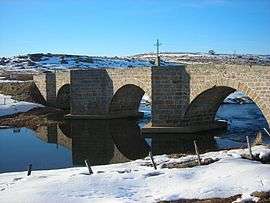
The Marchastel bridge, over the river Bès | |
 Marchastel | |
|
Location within Occitanie region  Marchastel | |
| Coordinates: 44°39′07″N 3°06′27″E / 44.6519°N 3.10750°ECoordinates: 44°39′07″N 3°06′27″E / 44.6519°N 3.10750°E | |
| Country | France |
| Region | Occitanie |
| Department | Lozère |
| Arrondissement | Mende |
| Canton | Nasbinals |
| Intercommunality | l'Aubrac lozérien |
| Government | |
| • Mayor (2008–2014) | Éric Malherbe[1] |
| Area1 | 34.87 km2 (13.46 sq mi) |
| Population (1999)2 | 73 |
| • Density | 2.1/km2 (5.4/sq mi) |
| Time zone | CET (UTC+1) |
| • Summer (DST) | CEST (UTC+2) |
| INSEE/Postal code | 48091 / 48260 |
| Elevation |
1,139–1,304 m (3,737–4,278 ft) (avg. 1,200 m or 3,900 ft) |
|
1 French Land Register data, which excludes lakes, ponds, glaciers > 1 km² (0.386 sq mi or 247 acres) and river estuaries. 2 Population without double counting: residents of multiple communes (e.g., students and military personnel) only counted once. | |
Marchastel is a commune in the Lozère department in southern France.
See also
References
| Wikimedia Commons has media related to Marchastel, Lozère. |
This article is issued from Wikipedia - version of the 2/11/2016. The text is available under the Creative Commons Attribution/Share Alike but additional terms may apply for the media files.