Nivolas-Vermelle
| Nivolas-Vermelle | ||
|---|---|---|
|
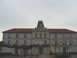
Town hall | ||
| ||
 Nivolas-Vermelle | ||
|
Location within Auvergne-Rhône-Alpes region  Nivolas-Vermelle | ||
| Coordinates: 45°33′27″N 5°18′26″E / 45.5575°N 5.3072°ECoordinates: 45°33′27″N 5°18′26″E / 45.5575°N 5.3072°E | ||
| Country | France | |
| Region | Auvergne-Rhône-Alpes | |
| Department | Isère | |
| Arrondissement | La Tour-du-Pin | |
| Canton | Bourgoin-Jallieu-Sud | |
| Intercommunality | Porte de l'Isère | |
| Government | ||
| • Mayor (2014–2020) | Michel Rival | |
| Area1 | 6.09 km2 (2.35 sq mi) | |
| Population (2011)2 | 2,384 | |
| • Density | 390/km2 (1,000/sq mi) | |
| Time zone | CET (UTC+1) | |
| • Summer (DST) | CEST (UTC+2) | |
| INSEE/Postal code | 38276 / 38300 | |
| Elevation | 258–441 m (846–1,447 ft) | |
|
1 French Land Register data, which excludes lakes, ponds, glaciers > 1 km² (0.386 sq mi or 247 acres) and river estuaries. 2 Population without double counting: residents of multiple communes (e.g., students and military personnel) only counted once. | ||

Nivolas-Vermelle is a commune in the Isère department in southeastern France.
Geography
The Bourbre forms most of the commune's northeastern border.
Population
| Historical population | ||
|---|---|---|
| Year | Pop. | ±% |
| 1881 | 975 | — |
| 1891 | 1,006 | +3.2% |
| 1901 | 1,268 | +26.0% |
| 1911 | 1,265 | −0.2% |
| 1921 | 1,186 | −6.2% |
| 1931 | 1,494 | +26.0% |
| 1946 | 1,122 | −24.9% |
| 1954 | 1,161 | +3.5% |
| 1962 | 1,187 | +2.2% |
| 1968 | 1,372 | +15.6% |
| 1975 | 1,699 | +23.8% |
| 1982 | 1,615 | −4.9% |
| 1990 | 1,638 | +1.4% |
| 1999 | 1,823 | +11.3% |
| 2006 | 2,181 | +19.6% |
| 2011 | 2,385 | +9.4% |
See also
References
| Wikimedia Commons has media related to Nivolas-Vermelle. |
This article is issued from Wikipedia - version of the 2/11/2016. The text is available under the Creative Commons Attribution/Share Alike but additional terms may apply for the media files.