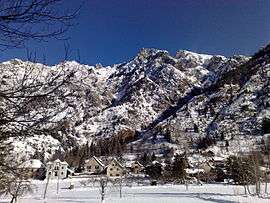
Valjouffrey
| Valjouffrey | |
|---|---|
 | |
 Valjouffrey | |
|
Location within Auvergne-Rhône-Alpes region  Valjouffrey | |
| Coordinates: 44°52′23″N 6°01′55″E / 44.8731°N 6.0319°ECoordinates: 44°52′23″N 6°01′55″E / 44.8731°N 6.0319°E | |
| Country | France |
| Region | Auvergne-Rhône-Alpes |
| Department | Isère |
| Arrondissement | Grenoble |
| Canton | Valbonnais |
| Intercommunality | Vallées du Valbonnais |
| Government | |
| • Mayor (2014–2020) | Bernard Héritier |
| Area1 | 127.55 km2 (49.25 sq mi) |
| Population (2012)2 | 156 |
| • Density | 1.2/km2 (3.2/sq mi) |
| Time zone | CET (UTC+1) |
| • Summer (DST) | CEST (UTC+2) |
| INSEE/Postal code | 38522 / 38740 |
| Elevation |
923–3,564 m (3,028–11,693 ft) (avg. 1,014 m or 3,327 ft) |
|
1 French Land Register data, which excludes lakes, ponds, glaciers > 1 km² (0.386 sq mi or 247 acres) and river estuaries. 2 Population without double counting: residents of multiple communes (e.g., students and military personnel) only counted once. | |
Valjouffrey is a commune in the Isère department in southeastern France.
Population
| Historical population | ||
|---|---|---|
| Year | Pop. | ±% |
| 1793 | 739 | — |
| 1806 | 766 | +3.7% |
| 1821 | 782 | +2.1% |
| 1831 | 840 | +7.4% |
| 1841 | 971 | +15.6% |
| 1851 | 990 | +2.0% |
| 1861 | 897 | −9.4% |
| 1872 | 891 | −0.7% |
| 1881 | 880 | −1.2% |
| 1891 | 847 | −3.7% |
| 1901 | 745 | −12.0% |
| 1911 | 669 | −10.2% |
| 1921 | 543 | −18.8% |
| 1931 | 481 | −11.4% |
| 1946 | 250 | −48.0% |
| 1954 | 228 | −8.8% |
| 1962 | 154 | −32.5% |
| 1968 | 124 | −19.5% |
| 1975 | 109 | −12.1% |
| 1982 | 107 | −1.8% |
| 1990 | 164 | +53.3% |
| 2006 | 136 | −17.1% |
| 2012 | 156 | +14.7% |
See also
References
| Wikimedia Commons has media related to Valjouffrey. |
This article is issued from Wikipedia - version of the 2/11/2016. The text is available under the Creative Commons Attribution/Share Alike but additional terms may apply for the media files.