Puyrenier
| Puyrenier | ||
|---|---|---|
|
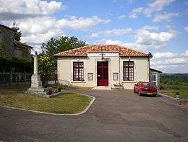
Town hall | ||
| ||
 Puyrenier | ||
|
Location within Nouvelle-Aquitaine region  Puyrenier | ||
| Coordinates: 45°28′47″N 0°28′29″E / 45.4797°N 0.4747°ECoordinates: 45°28′47″N 0°28′29″E / 45.4797°N 0.4747°E | ||
| Country | France | |
| Region | Nouvelle-Aquitaine | |
| Department | Dordogne | |
| Arrondissement | Nontron | |
| Canton | Mareuil | |
| Intercommunality | Pays de Mareuil-en-Périgord | |
| Government | ||
| • Mayor (2008–2014) | Pierre Varaillon | |
| Area1 | 7.42 km2 (2.86 sq mi) | |
| Population (2008)2 | 61 | |
| • Density | 8.2/km2 (21/sq mi) | |
| Time zone | CET (UTC+1) | |
| • Summer (DST) | CEST (UTC+2) | |
| INSEE/Postal code | 24344 / 24340 | |
| Elevation |
105–203 m (344–666 ft) (avg. 150 m or 490 ft) | |
|
1 French Land Register data, which excludes lakes, ponds, glaciers > 1 km² (0.386 sq mi or 247 acres) and river estuaries. 2 Population without double counting: residents of multiple communes (e.g., students and military personnel) only counted once. | ||

Puyrenier is a commune in the Dordogne department in Nouvelle-Aquitaine in southwestern France.
Geography
The Lizonne forms the commune's northern border.
Population
| Historical population | ||
|---|---|---|
| Year | Pop. | ±% |
| 1962 | 68 | — |
| 1968 | 58 | −14.7% |
| 1975 | 63 | +8.6% |
| 1982 | 52 | −17.5% |
| 1990 | 62 | +19.2% |
| 1999 | 55 | −11.3% |
| 2008 | 61 | +10.9% |
See also
References
| Wikimedia Commons has media related to Puyrenier. |
This article is issued from Wikipedia - version of the 11/9/2016. The text is available under the Creative Commons Attribution/Share Alike but additional terms may apply for the media files.